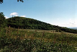
Geisingberg
Appearance
| Geisingberg | |
|---|---|
 | |
| Highest point | |
| Elevation | 824 m (2,703 ft) |
| Prominence | 110 m → Brautstock |
| Isolation | 1.8 km → Raubennest |
| Coordinates | 50°46′19″N 13°46′24″E / 50.77194°N 13.773444°E |
| Geography | |
| Parent range | Ore Mountains |
| Geology | |
| Mountain type | cone |
| Type of rock | basalt |
| Climbing | |
| Access | Tower inaugurated in 1891 |
The Geisingberg is a striking basalt mountain in the eastern Ore Mountains in the German federal state of Saxony.
Location and surrounding area
The Geisingberg lies in the upper
Müglitz Valley Railway
. With a maximum incline here of 1:27 (37 per mil) it is one of the steepest working railway lines in Germany.
Walking routes to the summit
- The easiest ascent runs from Altenberg along the road to the summit.
- Other walks being in Geising and Bärenstein.
- The Eisenach–Budapest international mountain path runs over the Geisingberg.
See also
- List of mountains in the Ore Mountains
- The Gaising (Latvian: Gaiziņkalns), the highest point in Latvia.
References
External links
Wikimedia Commons has media related to Geisingberg.
- Information about the Geisingberg Nature Reserve
- Homepage of the Bergbaude Geisingberg (with information about its history and geology)

