
Glenmacnass Waterfall
| Glenmacnass Waterfall | |
|---|---|
| Gleann Log an Easa | |
 | |
 | |
| Location | Wicklow Mountains, Ireland |
| Coordinates | 53°03′51″N 6°20′13″W / 53.064223°N 6.33688°W |
| Type | Cascade |
| Elevation | 350 metres (1,150 ft) |
| Total height | 80 metres (260 ft) |
| Number of drops | 3 |
| Watercourse | Glenmacnass River |
Glenmacnass Waterfall (
Geography
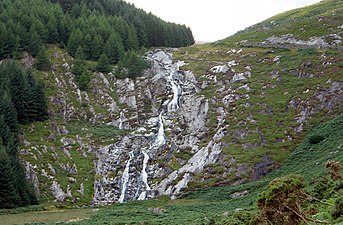
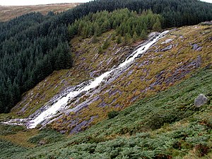
The Glenmacnass River begins high up on the southeast slopes of Mullaghcleevaun 849 metres (2,785 ft), with smaller tributaries flowing in from the eastern slopes of Tonelagee 817 metres (2,680 ft); the river then reaches the top of the waterfall at an elevation of 350 metres (1,150 ft) above sea-level, where it falls 80 metres (260 ft) down the waterfall in 3 staggered drops to an elevation of 270 metres (890 ft) above sea-level, where it reaches the Glenmacnass Valley floor.[2][3]
The river continues through the
Geology
Glenmacnass Waterfall flows over grey-colored, smooth
Access
The Glenmacnass Waterfall is a popular tourist destination and scenic viewpoint area in the Wicklow Mountains, and the entire Glenmacnass Valley can be accessed by the
Gallery
-
 Mist on the waterfall
 -
 From south
 -
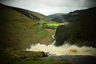 Heavy flow
 -
 From Military Road
 -
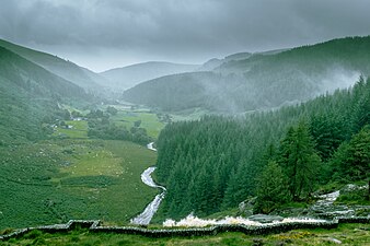
 Glenmacnass valley
 -
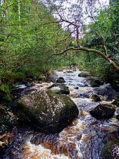 Glenmacnass River above Laragh


See also
References
- ^ "Gleann Log an Easa". Logainm (Placenames database of Ireland). Retrieved 17 July 2019.
- ^ a b c d e f g h "WICKLOW - COUNTY GEOLOGICAL SITE REPORT: Glenmacnass Valley" (PDF). Geological Survey of Ireland. 2014. Retrieved 17 July 2019.
- ^ ISBN 978-1852841102.
Walk 6: Tonelagee, Scarr
- ^ ISBN 1-903765-20-X.
External links
- Glenmacnass Waterfall Visit Wicklow (2018)
| Protected Areas |
| ||||||||||||||||
|---|---|---|---|---|---|---|---|---|---|---|---|---|---|---|---|---|---|
| Landforms |
| ||||||||||||||||