
Gradec, Zagreb
This article needs additional citations for verification. (February 2009) |


Gradec (Croatian pronunciation:
History
Gradec was given a royal charter by King
The citizens engaged in building defensive walls and towers around their settlement, fearing a new Mongol invasion. They completed the defensive system at a time between 1242 and 1261. It could be rightly assumed that by building its fortification walls in the middle of the 13th century, Gradec acquired its outward appearance that can be clearly seen in today's Upper Town (Gornji Grad). The defensive walls enclosed the settlement in the shape of a triangle, its top located near the tower called Popov toranj and its base at the south wall (today's Strossmayer Promenade) and Lotrščak tower, which could be explained by the shape of the hill. In some places, rectangular and semicircular towers fortified the defensive walls.
There were four main gates leading to the town: the west gate in the Mesnička Street, the new north gate, later known as the Opatička Street gate, Dverce in the south and the Kamenita vrata (English: Stone gate) in the east. Kamenita vrata is the only gate still preserved to date.
Gornji Grad today
Gornji Grad is a local government unit, encompassing a population of 3,432.[1]
Undoubtedly, the focal point of Gornji Grad is the square around St. Mark's Church that had been called St. Mark's Square for years. St. Mark's Church is the parish church of Old Zagreb. When guilds developed in Gradec in the 15th, and later in the 17th century, being the societies of craftsmen, their members including masters, journeymen and apprentices would gather regularly in St. Mark's Church.
On the opposite side of the Square at the corner of Basaričekova Street lies the St. Mark's parish office. The house has been standing there since the 16th century, although it underwent reconstruction in the 18th century and had an extension added in the 19th century. At the west end of St. Mark's Square, the mansion called
In 2008, Gornji Grad was closed to car traffic except for residents, making it a primarily pedestrian zone.[2] In 2014, Zagreb Administrative Court struck down the order prohibiting other cars from parking at residents' parking spaces, and car access and parking was again allowed on Gornji Grad, albeit at a hefty fee for non-residents.[3][4]

Climate
Since records began in 1881, the highest temperature recorded at the Grič weather station at an elevation of 157 metres (515 ft) was 40.3 °C (104.5 °F), on 5 July 1950.[5] The coldest temperature was −22.2 °C (−8.0 °F), on 24 January 1942.[6]
See also
- History of Zagreb
- History of Croatia
- Zagreb cathedral
- Kaptol
- Ban Jelačić Square
- Grič cannon
- Grič Tunnel
Views of Gradec
-
 The statue of St George killing the dragon
 -
 Juraj Julije Klovićstatue in front of the eponymous gallery
 -
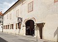 Zagreb City Museum
 -
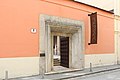 Meštrović Atelier


References
- ^ Zagreb.hr – 2. Mjesni odbor Gornji grad
- ^ Kekić, Jasmina (2008-05-29). "Gornji grad napokon postaje zona rezervirana za pješake" (PDF, 144 KB). Vjesnik (in Croatian). Retrieved 2008-08-03.[permanent dead link]
- 24 sata(in Croatian). 12 September 2014. Retrieved 16 April 2018.
- ^ Kožul, Dijana (27 November 2014). "Od sutra počinje naplata parkiranja na Gornjem gradu". Večernji list (in Croatian). Retrieved 16 April 2018.
- ^ DHMZ (2022-07-19). "Najviše izmjerene temperature zraka u Hrvatskoj za razdoblje od kada postoje mjerenja". Državni hidrometeorološki zavod.
- ^ DHMZ (2022-01-21). "Najniže izmjerene temperature zraka u Hrvatskoj za razdoblje od kada postoje mjerenja". Državni hidrometeorološki zavod.
External links
- http://www.guide.ndo.co.uk/html/oldzagreb.html
- https://web.archive.org/web/20111112164609/http://www.zagreb-city.info/zagreb-photos/43-zagreb-gradec-upper-town/55-gradecgornji-grad-upper-town-zagreb-
