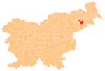
Grajenščak
Grajenščak | |
|---|---|
Styria | |
| Statistical region | Drava |
| Municipality | Ptuj |
| Area | |
| • Total | 4.42 km2 (1.71 sq mi) |
| Elevation | 336.2 m (1,103.0 ft) |
| Population (2002) | |
| • Total | 444 |
| [1] | |
Grajenščak (pronounced Styria. It is now included with the rest of the municipality in the Drava Statistical Region.[3]
References
- ^ Statistical Office of the Republic of Slovenia
- ^ Leksikon občin kraljestev in dežel zastopanih v državnem zboru, vol. 4: Štajersko. Vienna: C. Kr. Dvorna in Državna Tiskarna. 1904. p. 245.
- ^ Ptuj municipal site
External links
 Media related to Grajenščak at Wikimedia Commons
- Grajenščak on Geopedia

