
Harbour Island, Bahamas
District of Harbour Island | |
|---|---|
| Nickname: Briland | |
EDT) | |
| Area code | 242 |
Harbour Island is an island and administrative district in
It has a population of 1,762 (2010 census).[2] The only town on the island is Dunmore Town, named after the governor of the Bahamas from 1786 to 1798, John Murray, 4th Earl of Dunmore, who had a summer residence on Harbour Island.
Tourism
Harbour Island is famous for its pink sand beaches, which are found all along the east side of the island. The pink hue comes from a species of foraminifera, a microscopic organism that actually has a reddish-pink shell. Harbour Island is a popular vacation destination for Americans. Known as Briland to the locals, Harbour Island is colourful with English Colonial-style buildings and flower lined streets. Harbour Island is part of the Out Islands of the Bahamas.
In the middle 1960s, the American actor Brett King and his wife, Sharon, established the Coral Sands Hotel in Harbour Island.
Transportation
The island is accessible by airplane through North Eleuthera Airport, followed by a short water taxi ride from neighbouring North Eleuthera.
Gallery
-
 Pink sand beach near Sip Sip's, Harbour Island, looking north
 -
 Horses on Harbour Island, looking east
 -
 Sunset on Harbour Island, looking north
 -
 Dunmore School kids in Junkanoo 2008, Harbour Island, looking east
 -
 Sunset over Government Dock and harbour, Harbour Island, looking west from Dunmore School
 -
 Dunmore School of Harbour Island, looking east from harbour shoreline
 -
 Sunrise from the north part of the island
 -
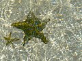 Starfish in the harbour on Harbour Island
 -
 The pink beach of Harbour Island


References
- ^ "Census population and housing" (PDF). Bahamas Gov. Retrieved 17 April 2023.
- ^ HARBOUR ISLAND POPULATION BY SETTLEMENT AND TOTAL NUMBER OF OCCUPIED DWELLINGS: 2010 CENSUS - Bahamas Department of Statistics
Sources
- The Harbour Island Story, Anne & Jim Lawlor (Macmillan Caribbean, 2008) ISBN 978-0-333-97051-5
- The Story of The Bahamas, Paul Albury (Macmillan Caribbean, London, 1975) ISBN 0-333-17132-2
- Out Island Doctor, Evan Cottman
- Under The plop o lop Tree, Pip Simmons, editor; 'Uncle Gundy' narrator, Barbra Young Photographs
- 99-Cent Breakfast, Patricia Glinton-Meicholas
- Bahamian Scene, Susan J. Wallace
- Wind From The Carolinas, Robert Wilder
- Islanders in the Stream: A History of the Bahamian People - Volume One: From Aboriginal Times to the End of Slavery, Michael Craton and Gail Saunders (University of Georgia Press, Athens, 1999) ISBN 0-8203-2122-2
25°30′N 76°38′W / 25.500°N 76.633°W
| Authority control databases: Geographic |
|---|