
Hartford, Kansas
Hartford, Kansas | ||
|---|---|---|
FIPS code 20-30475 | | |
| GNIS ID | 2394308[1] | |
Hartford is a city in Lyon County, Kansas, United States.[1] As of the 2020 census, the population of the city was 355.[4]
History
Hartford was laid out in 1858.[5] Some of its founders were original natives of Hartford, Connecticut, hence the name.[6][7]
Hartford was incorporated as a city in March 1884.[8]
Geography
According to the United States Census Bureau, the city has a total area of 0.38 square miles (0.98 km2), all land.[9]
Demographics
| Census | Pop. | Note | %± |
|---|---|---|---|
| 1890 | 441 | — | |
| 1900 | 553 | 25.4% | |
| 1910 | 589 | 6.5% | |
| 1920 | 575 | −2.4% | |
| 1930 | 516 | −10.3% | |
| 1940 | 491 | −4.8% | |
| 1950 | 395 | −19.6% | |
| 1960 | 337 | −14.7% | |
| 1970 | 478 | 41.8% | |
| 1980 | 551 | 15.3% | |
| 1990 | 541 | −1.8% | |
| 2000 | 500 | −7.6% | |
| 2010 | 371 | −25.8% | |
| 2020 | 355 | −4.3% | |
| U.S. Decennial Census | |||
Hartford is part of the
2020 census
The
Of the 155 households, 23.9% had children under the age of 18; 45.8% were married couples living together; 29.0% had a female householder with no spouse or partner present. 30.3% of households consisted of individuals and 13.5% had someone living alone who was 65 years of age or older.[11] The average household size was 2.6 and the average family size was 3.3.[15] The percent of those with a bachelor’s degree or higher was estimated to be 10.1% of the population.[16]
20.8% of the population was under the age of 18, 7.3% from 18 to 24, 22.5% from 25 to 44, 30.4% from 45 to 64, and 18.9% who were 65 years of age or older. The median age was 43.6 years. For every 100 females, there were 82.1 males.[11] For every 100 females ages 18 and older, there were 95.1 males.[11]
The 2016-2020 5-year
2010 census
As of the
There were 160 households, of which 30.6% had children under the age of 18 living with them, 41.3% were married couples living together, 12.5% had a female householder with no husband present, 7.5% had a male householder with no wife present, and 38.8% were non-families. 33.8% of all households were made up of individuals, and 14.4% had someone living alone who was 65 years of age or older. The average household size was 2.25 and the average family size was 2.87.
The median age in the city was 44.6 years. 23.5% of residents were under the age of 18; 8.9% were between the ages of 18 and 24; 18.3% were from 25 to 44; 32.3% were from 45 to 64; and 17% were 65 years of age or older. The gender makeup of the city was 52.3% male and 47.7% female.
2000 census
At the 2000
There were 200 households, of which 33.0% had children under the age of 18 living with them, 51.0% were married couples living together, 9.5% had a female householder with no husband present, and 37.5% were non-families. 33.5% of all households were made up of individuals, and 11.5% had someone living alone who was 65 years of age or older. The average household size was 2.35 and the average family size was 3.06.
26.0% of the population were under the age of 18, 5.8% from 18 to 24, 29.4% from 25 to 44, 24.0% from 45 to 64, and 14.8% who were 65 years of age or older. The median age was 39 years. For every 100 females, there were 104.1 males. For every 100 females age 18 and over, there were 103.3 males.
The
Education
The community is served by Southern Lyon County USD 252 public school district.
See also
- National Register of Historic Places listings in Lyon County, Kansas
- John Redmond Dam and Reservoir
- Great Flood of 1951
References
- ^ a b c d U.S. Geological Survey Geographic Names Information System: Hartford, Kansas
- ^ a b "City of Hartford". The League of Kansas Municipalities. May 24, 2019.
- ^ "2019 U.S. Gazetteer Files". United States Census Bureau. Retrieved July 24, 2020.
- ^ a b "Profile of Hartford, Kansas in 2020". United States Census Bureau. Archived from the original on May 3, 2022. Retrieved May 3, 2022.
- ^ Blackmar, Frank Wilson (1912). Kansas: A Cyclopedia of State History, Embracing Events, Institutions, Industries, Counties, Cities, Towns, Prominent Persons, Etc. Standard Publishing Company. pp. 812.
- ^ Gannett, Henry (1905). The Origin of Certain Place Names in the United States. Govt. Print. Off. pp. 151.
- ISBN 9780974435886.
- ISBN 9780788403460.
- ^ "US Gazetteer files 2010". United States Census Bureau. Retrieved July 6, 2012.
- ^ "US Census Bureau, Table P16: HOUSEHOLD TYPE". data.census.gov. Retrieved January 3, 2024.
- ^ a b c d e "US Census Bureau, Table DP1: PROFILE OF GENERAL POPULATION AND HOUSING CHARACTERISTICS". data.census.gov. Retrieved January 3, 2024.
- ^ Bureau, US Census. "Gazetteer Files". Census.gov. Retrieved December 30, 2023.
- ^ "US Census Bureau, Table P1: RACE". data.census.gov. Retrieved January 3, 2024.
- ^ "US Census Bureau, Table P2: HISPANIC OR LATINO, AND NOT HISPANIC OR LATINO BY RACE". data.census.gov. Retrieved January 3, 2024.
- ^ "US Census Bureau, Table S1101: HOUSEHOLDS AND FAMILIES". data.census.gov. Retrieved January 3, 2024.
- ^ "US Census Bureau, Table S1501: EDUCATIONAL ATTAINMENT". data.census.gov. Retrieved January 3, 2024.
- ^ "US Census Bureau, Table S1903: MEDIAN INCOME IN THE PAST 12 MONTHS (IN 2020 INFLATION-ADJUSTED DOLLARS)". data.census.gov. Retrieved January 3, 2024.
- ^ "US Census Bureau, Table S2001: EARNINGS IN THE PAST 12 MONTHS (IN 2020 INFLATION-ADJUSTED DOLLARS)". data.census.gov. Retrieved January 3, 2024.
- ^ "US Census Bureau, Table S1701: POVERTY STATUS IN THE PAST 12 MONTHS". data.census.gov. Retrieved January 3, 2024.
- ^ "US Census Bureau, Table S1702: POVERTY STATUS IN THE PAST 12 MONTHS OF FAMILIES". data.census.gov. Retrieved January 3, 2024.
- ^ "U.S. Census website". United States Census Bureau. Retrieved July 6, 2012.
- ^ "U.S. Census website". United States Census Bureau. Retrieved January 31, 2008.
Further reading
External links
Municipalities and communities of Lyon County, Kansas, United States | ||
|---|---|---|
| Cities | 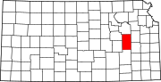 | |
| Unincorporated communities | ||
| Townships | ||
| ||
| International | |
|---|---|
| National | |