
Haut-Folin
| Haut-Folin | |
|---|---|
 | |
| Highest point | |
| Elevation | 901 m (2,956 ft) |
| Coordinates | 46°59′45″N 4°2′14″E / 46.99583°N 4.03722°E |
| Geography | |
 Haut-Folin Location in France | |
| Location | Saône-et-Loire, France |
| Parent range | Morvan |
Haut-Folin (French pronunciation: mountain range.
It forms part of the drainage divide between the Seine and Loire rivers.
It is located in the commune of Saint-Prix.
There is a 40 km of cross-country skiing ski resort.
-
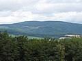 Haut folin view from Mont Beuvray
 -
 Television relay station

.jpg)
This Saône-et-Loire geographical article is a stub. You can help Wikipedia by expanding it. |