
Hermite Islands
Native name: Islas Hermite or L'Hermite Nickname: Samajani (Yahgan Language) Antártica | |
|---|---|
| Commune | Cabo de Hornos |
| Additional information | |
| NGA UFI= -884095 | |
The Hermite Islands (Spanish: Islas Hermite) are the islands Hermite, Herschel, Deceit and Hornos as well as the islets Maxwell, Jerdán, Arrecife, Chanticleer, Hall, Deceit (islet), and Hasse at almost the southernmost end of South America.[1] The smallest and southernmost of the major islands is Hornos Island, the location of Cape Horn. The islands are located south of the Wollaston Islands and separated from them by the Franklin Channel. The islets Terhalten, Sesambre, Evout and Barnevelt are located easterly and are not considered part of the Hermite islands.
The southernmost islands of the American continent are the Diego Ramírez Islands, southwest of Cape Horn. South of all these islands is the Drake Passage.
The southern tip of Deceit island extends southeastwards through a line of sharp-edged rocks known as Los dientes o garras de Deceit (the Teeth or Claws of Deceit) that end in a rough islet, Islote Deceit. The islands form part of the Cabo de Hornos National Park.
History
They are named after the Dutch admiral
.
-
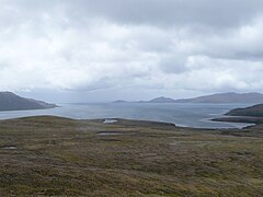 Landscape in the Hermite Islands
 -
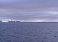 Teeth of Deceit
 -
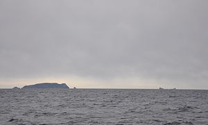
 Barnevelt Island
 -
 Evout Island


See also
- List of islands of Chile
- Beagle conflict
 Media related to Hermite Islands at Wikimedia Commons
References
- ^ a b 7. Cabo de Hornos , retrieved on 14 February 2013