Hora Sfakion


Hóra Sfakíon (
Hóra Sfakíon is a small village with a main harbourfront of tavernas, two minimarkets, a butcher, and a bakery. There is a quiet local beach immediately west of the village, and several pebbly beaches nearby. Hóra Sfakíon has a variety of tourist accommodations: rooms, studios, and apartments. The local economy is based on tourism, fishing, olive-oil production, and sheep and goat herding.
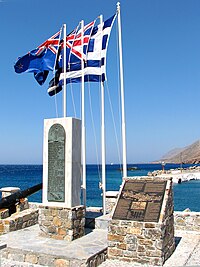
Hóra Sfakíon prospered during the Venetian and Turkish occupations and up to the 18th century carried on a flourishing trade with its own small fleet. It was said to have had a hundred churches, but it suffered badly from wartime bombardment during the Battle of Crete and the Allied evacuation that followed.
Hóra Sfakíon is famous as one of the centers of resistance against the occupying forces of both the Venetians and the Turks. The impenetrable White Mountains to the north combined with the rocky beaches on the south helped the locals fight off all invaders. Anopolis, a village near Hóra Sfakíon, is the birthplace of one of the most celebrated Cretan revolutionaries, Daskalogiannis.
See also
References
- ^ Απογραφή Πληθυσμού - Κατοικιών 2011. ΜΟΝΙΜΟΣ Πληθυσμός (in Greek). Hellenic Statistical Authority.
