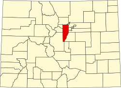
Idledale, Colorado
Appearance
Idledale, Colorado | |
|---|---|
303 & 720 | |
| GNIS feature[2] | Idledale CDP |
Idledale is an
United States Census 2020, the population of the Idledale CDP was 244.[3]
History
Originally called "Starbuck Heights", the town was almost washed out by a storm in 1933. When it was rebuilt, the town became known as Idledale.[2]
Geography
Idledale is located on the north side of
Bear Creek Canyon Scenic Mountain Drive and leads downstream 4 miles (6 km) to Morrison; to the west the highway leads up the canyon the same distance to Kittredge
.
The Idledale CDP has an area of 177 acres (0.717 km2), all land.[1]
Demographics
The
United States Census 2010
.
| Year | Pop. | ±% |
|---|---|---|
| 2010 | 252 | — |
| 2020 | 244 | −3.2% |
| Source: United States Census Bureau | ||
Education
Idledale is served by the Jefferson County Public Schools.
See also
- Outline of Colorado
- State of Colorado
- Colorado cities and towns
- Colorado census designated places
- Colorado counties
- Colorado metropolitan areas
- Front Range Urban Corridor
- North Central Colorado Urban Area
- Denver-Aurora-Boulder, CO Combined Statistical Area
- Denver-Aurora-Broomfield, CO Metropolitan Statistical Area
References
- ^ a b c "State of Colorado Census Designated Places - BAS20 - Data as of January 1, 2020". United States Census Bureau. Retrieved December 18, 2020.
- ^ a b c d "U.S. Board on Geographic Names: Domestic Names". United States Geological Survey. Retrieved December 18, 2020.
- ^ a b United States Census Bureau. "Idledale CDP, Colorado". Retrieved April 15, 2023.
- ^ a b "Look Up a ZIP Code". United States Postal Service. Retrieved December 18, 2020.

