
Isis Highway
Isis Highway | |
|---|---|
 | |
| Isis Highway (green and black) | |
| General information | |
| Type | Highway |
| Length | 137 km (85 mi) |
| Route number(s) |
|
| Major junctions | |
| NE end | Biggenden |
| Highway system | |
The Isis Highway is a state
The highway takes its name from the
The Isis Highway is signed as State Route 3 between Bundaberg and Childers, and State Route 52 between Childers and Ban Ban Springs. The section between Bundaberg and Childers is a state-controlled regional road (number 19A) while that between Childers and Ban Ban Springs is a state-controlled strategic road (numbers 19B and 19C)[3]
Route description
The road commences at a roundabout in Bundaberg North[4] as State Route 3 and runs south as Hinkler Avenue, crossing the Burnett River on the Don Tallon Bridge. Most of this section is one lane in each direction. After 2.0 kilometres (1.2 mi) it passes through a five-way intersection, crossing Bourbong Street and turning south-west on Takalvan Street. This four lane road continues for a further 3.3 kilometres (2.1 mi) to the Airport Drive / Kendalls Road exit, where it becomes Childers Road, reverting to two lanes.
Childers Road passes to the west of Bundaberg Airport and through the outer suburbs of Kensington and Branyan before reaching the village of South Bingera. From there to Apple Tree Creek it passes through a mixture of farm land and forest, with sugar cane and other crops intermixed. Childers Road is 41.8 kilometres (26.0 mi) in length, making a cumulative distance to the Bruce Highway at Apple Tree Creek of 47.1 kilometres (29.3 mi).
From Apple Tree Creek the Isis Highway runs south-east concurrent with the Bruce Highway for 6.4 kilometres (4.0 mi) to the western outskirts of the town of
Roads of Strategic Importance upgrade
The Roads of Strategic Importance initiative, last updated in March 2022, includes the following project for the Isis Highway.
Overtaking lanes
A project to construct overtaking lanes on the Isis Highway, at an estimated cost of $5 million, was completed in mid-2021.[5]
Other upgrades
A project to improve safety in various locations, at a cost of $41.8 million, was expected to be completed in 2024.[6]
Towns along the Isis Highway
- Bundaberg
- Cordalba
- Childers
- Dallarnil
- Degilbo
- Biggenden
- Coalstoun Lakes
Major intersections
| LGA | Location | km | mi | Destinations | Notes |
|---|---|---|---|---|---|
Bundaberg CBD Fairymead Road – north – Fairymead | Roundabout intersection. Northern end of Isis Highway (State Route 3). State Route 3 continues west to Gin Gin. | ||||
| Burnett River | 1.1– 1.7 | 0.68– 1.1 | Don Tallon Bridge | ||
| Bundaberg | Bundaberg West | 2.0 | 1.2 | Bundaberg–Bargara Road (Bourbong Street) – east – Bundaberg CBD Bourbong Street – west – Millbank Mulgrave Street – south – Bundaberg West | Five-way intersection. Isis Highway continues south–west as Takalvan Street. |
| Apple Tree Creek | 47.1 | 29.3 | south–east – Childers | Northern concurrency terminus with Bruce Highway | |
Wide Bay-Burnett | Childers | 53.5 | 33.2 | Southern concurrency terminus with Bruce Highway. | |
| 53.5 | 33.2 | Isis Highway continues south as State Route 52. | |||
Biggenden | 99.3 | 61.7 | |||
Goomeri | |||||
1.000 mi = 1.609 km; 1.000 km = 0.621 mi
| |||||
Gallery
-
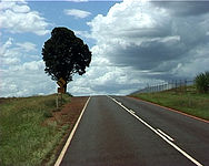 Isis Highway between Apple Tree Creek and Bundaberg

See also
- Australian Roads portal
 Queensland portal
References
- ^ Queensland Government - Department of Transport and Main Roads - Maps
- ISBN 978-1-86500-456-3.
- ^ The State Road Network of Queensland (PDF) (Map). Queensland Government. 30 June 2019. Archived (PDF) from the original on 30 March 2014. Retrieved 10 August 2021.
- ^ Wide Bay District Map Page 2 Bundaberg Environs (PDF) (Map). Department of Transport and Main Roads ©State of Queensland [CC BY 4.0]. March 2007. Retrieved 10 August 2021.
- ^ "Isis Overtaking Lanes". Department of Infrastructure, Transport, Regional Development and Communications. 27 October 2021. Retrieved 6 May 2022.
- ^ "Isis Highway (Bundaberg – Childers), various locations, improve safety". Queensland Government. 22 November 2021. Retrieved 28 June 2022.