Jaragua National Park
Jaragua National Park | |
|---|---|
Reserve | |
 | |
| Coordinates: 17°, 28" N to 17°, 58" N and from 71°, 16" W to 71°, 44" W | |
| Area | |
| • Total | 1,374 km2 (531 sq mi) |
| • Water | 905 km2 (349 sq mi) |
Jaragua National Park (
Pedernales Province in the extreme southwest of the Dominican Republic. Jaragua National Park has a total area of 1,374 km² (905 km² of which are marine), making it the largest protected area in the Caribbean region.[1]
Geography
Jaragua National Park was established by Presidential Decree No. 1315 on August 11, 1983, and was named after the
scrub
, as well as land and marine habitats.
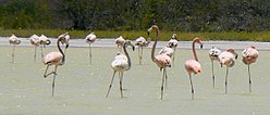
Beata Island (Isla Beata), Alto Velo Island, Bahía de las Águilas and Lago de Oviedo (noted for its diverse bird life) are part of the park.
Among the variety of habitats found in Jaragua, numerous lagoons are located within its boundaries: Laguna Oviedo, Laguna Salada, Manuel Matos, La Rabiza, Puerto en Medio, Bucán Base, and Salado Bucán.
It is the only protected area of the Paleoisla del Sur geoformation, and one of two land masses to for the island of La Hispaniola between 20,000 to 30,000 B.C.[2]
References
- ^ "Parque Nacional Jaragua (página 2)". Monografias.com (in Spanish). 2021-03-12. Retrieved 2022-03-18.
- ^ "Parque Nacional Jaragua Pedernales República Dominicana" (in Spanish). 2022-02-28. Retrieved 2022-03-18.
Sources
- Cohen, Saul B. (ed). "Parque Nacional Jaragua." Columbia Gazetteer of North America. New York: Columbia, 2002. [1]
- "Jaragua National Park, Dominican Republic." The Nature Conservancy. [2] Archived 2008-03-28 at the Wayback Machine
- "Jaragua National Park." UNESCO. [3]
