
Kharagauli Municipality
Kharagauli Municipality
ხარაგაულის მუნიციპალიტეტი | |
|---|---|
 Surami pass railway tunnel | |
|
UTC+4 (Georgian Standard Time) |
Kharagauli Municipality (Georgian: ხარაგაულის მუნიციპალიტეტი) is a district of Georgia, in the region of Imereti. Its main town is Kharagauli. It has an area of 914 km2. As of the 2014 census, its population was 19,473.
History
The historical territory of Kharagauli was part of the Margveti Saeristao. The "Silk Road" ran through here. During the feudal era, the present-day territory of Kharagauli was of strategic importance because of the roads connecting western and eastern Georgia. The historical monuments found here give grounds to assume that the Kharagauli area was a highly densely populated highway. This is evidenced by the ancestral tomb of the Pythians, which was found in the village of Bori. The places where now the town kharagauli located in the valley of the passengers resting place was leading caravans often rested in the Chkherimela valley wide-open area. The territory of Kharagauli municipality has been inhabited since the Stone Age. On the right bank of the river Chkherimela, in the rock of Khandebi, a cave-human settlement of the Upper Paleolithic period, " Deviskhvreli ", has been found. During the feudal era, the territory of the municipality was of strategic importance, because the roads connecting western and eastern Georgia passed through it.
Until 1917, the territory of Kharagauli municipality was included in Shorapani Mazra of
Politics
Kharagauli Municipal Assembly (Georgian: ხარაგაულის საკრებულო) is a representative body in Kharagauli Municipality. currently consisting of 33 members. The council is assembled into session regularly, to consider subject matters such as code changes, utilities, taxes, city budget, oversight of city government and more. Kharagauli sakrebulo is elected every four years. The last election was held in October 2021.[3]
| Party | 2017[4] | 2021[5] | Current Municipal Assembly | |||||||||||||||||||||||||||||||||||
|---|---|---|---|---|---|---|---|---|---|---|---|---|---|---|---|---|---|---|---|---|---|---|---|---|---|---|---|---|---|---|---|---|---|---|---|---|---|---|
| Georgian Dream | 28 | 24 | ||||||||||||||||||||||||||||||||||||
| United National Movement | 2 | 6 | ||||||||||||||||||||||||||||||||||||
| For Georgia | 2 | |||||||||||||||||||||||||||||||||||||
| Lelo | 1 | |||||||||||||||||||||||||||||||||||||
European Georgia
|
2 | |||||||||||||||||||||||||||||||||||||
| Development Movement | 2 | |||||||||||||||||||||||||||||||||||||
| Alliance of Patriots | 1 | |||||||||||||||||||||||||||||||||||||
| Total | 35 | 33 | ||||||||||||||||||||||||||||||||||||
Economy

The industry was developed during the
Tourism plays an important role in the economy of the municipality. This is facilitated by the Borjomi-Kharagauli National Park and the resort Nunisi, which is located on the territory of the municipality. The territory of the municipality plays a key role in the transport system of Georgia. It connects western and eastern Georgia with the Tsipi tunnel (3910 m.) And the Khandebi tunnel (740 m.). Georgian highway 1 and Khashuri-Samtredia railway section pass here. There are several railway stations on the territory of the municipality: Kharagauli, Moliti, Marelis, Tsipa.[1]
Agriculture
The main field for the district is agriculture. 1.5% of the total area of the municipality is used for agricultural purposes. In this area 70.9% is occupied by pastures, plowing and sowing suitable for 29.1% (annual crops occupy 22.5%, permanent crops - 22.5%, multi nargavebs - 6.6%) in agriculture are specially developed for breeding and Beekeeping. Municipal District of apiculture and the host fields of viticulture, Livestock.
Settlements
| Rank | Settlement | Population (2014) |
|---|---|---|
| 1 | Kharagauli | 1,965 |
| 2 | Vardzia | 959 |
| 3 | Ghoresha | 767 |
| 4 | Boriti | 557 |
Gallery
-

-
 Ubisi Monastery
 -
 Deviskhvreli cave in Kharagauli
 -
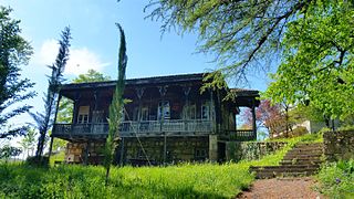 Sergo OrjonikidzeHouse Museum
.jpg)


See also
References
- ^ a b c "ხარაგაულის მუნიციპალიტეტის საინფორმაციო ვებ გვერდი". kharagaulinews.gov.ge. Retrieved 27 April 2024.
- ^ "Ethnic composition of Georgia 2014". mashke.org. Archived from the original on 4 November 2018.
- ^ Cesko [permanent dead link]
- ^ "Protocol elected municipal council members and mayors 2017" (PDF) (in Georgian). CESKO Central Election Commission. Retrieved 20 December 2021.[permanent dead link]
- ^ "Protocol elected municipal council members and mayors 2021" (PDF) (in Georgian). CESKO Central Election Commission. Retrieved 20 December 2022.[permanent dead link]
External links
- Districts of Georgia, Statoids.com
42°01′15″N 43°11′41″E / 42.02083°N 43.19472°E
| International | |
|---|---|
| National | |