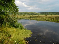
Kodyma (river)
| Kodyma | |
|---|---|
 | |
| Location | |
| Country | Ukraine |
| Physical characteristics | |
| Source | |
| • elevation | 165 m (541 ft) |
| Mouth | Southern Bug |
• coordinates | 48°00′25″N 30°48′33″E / 48.0070°N 30.8093°E |
| Length | 149 km (93 mi) |
| Basin size | 2,470 km2 (950 sq mi) |
| Basin features | |
| Progression | Southern Bug→ Dnieper–Bug estuary→ Black Sea |
The Kodyma (
right tributary of the Southern Bug river of Ukraine. Originating from springs in a boggy valley near the village of Budei (uk:Будеї), Podilsk Raion, Odesa Oblast, it flows within the Odesa Oblast and Mykolaiv Oblast and joins Southern Buh about 199 km away from its mouth, near Pervomaisk
.
Settlements by the river include Balta town, Holma village (uk:Гольма), Bobrik Pershy ("Bobrik the First", uk:Бобрик Перший), and Kryve Ozero urban-type settlement ("Crooked Lake").
Notes and references
