
Kotto River
| Kotto River | |
|---|---|
 | |
 | |
| Location | |
| Country | Central African Republic |
| Prefecture | Haute-Kotto, Basse-Kotto |
| Physical characteristics | |
| Source | Mount Toussoro, Bongo Massif |
Kembe | |
| • average | 447 m3/s[1] |
| • minimum | 77 m3/s[1] |
| • maximum | 1460 m3/s[1] |
| Basin features | |
| Progression | Ubangi River→ Congo River→ Atlantic Ocean |
| River system | Congo River |
| Tributaries | |
| • left | Kawadjia, Pipi, Ndji, Boungou |
The Kotto River (or Koto River) is a tributary of the
Oubangui River in the Central African Republic
.
Its source is on the south side of the
The Kotto River gives its name to two of the Central African Republic's sixteen prefectures, Haute-Kotto and Basse-Kotto.
- Historical views
-
 Steamboat on the Kotto.
 -
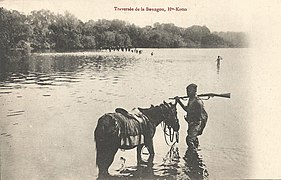 Crossing of the Boungou, a right tributary.

References
- ^ a b c d GRDC station information for Kembe
- ^ "Kotto River | river, north-central Africa | Britannica.com". britannica.com. Retrieved 2017-03-26.