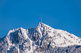
Le Chamossaire
| Le Chamossaire | |
|---|---|
 Le Chamossaire from the Rhone valley | |
| Highest point | |
| Elevation | 2,112 m (6,929 ft) |
| Prominence | 377 m (1,237 ft)[1] |
| Coordinates | 46°19′36″N 7°3′40.7″E / 46.32667°N 7.061306°E |
| Geography | |
| Location | Vaud, Switzerland |
| Parent range | Bernese Alps |
Le Chamossaire is a
Bex–Villars–Bretaye railway
and then a fast chairlift. Located more east is the Petit Chamossaire shoulder accessible via a brand new chairlift.
See also
References
- ^ Retrieved from the Swisstopo topographic maps and Google Earth. The key col is located south of the Col de la Croix at 1,735 metres.
External links
 Media related to Le Chamossaire at Wikimedia Commons
- Le Chamossaire on Hikr

