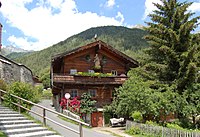
Lienz District
This article needs additional citations for verification. (January 2021) |
Lienz District
Bezirk Lienz | |
|---|---|
Tyrol | |
| Number of municipalities | 33 |
| Area | |
| • Total | 2,016.41 km2 (778.54 sq mi) |
| Population (2019) | |
| • Total | 53,833 |
| • Density | 27/km2 (69/sq mi) |
| Time zone | UTC+01:00 (CET) |
| • Summer (DST) | UTC+02:00 (CEST) |
The Bezirk Lienz (
) in the west.The area of the district is 2,016.41 square kilometres (778.54 sq mi) with a population of 48,833 o January 1, 2019, and population a density of 25 per square kilometre (65/sq mi). The administrative center of the district is Lienz.
In 1918, it was occupied by the Italian Army.Second World War, instead forming part of the British zone.
Geography
The district comprises parts of the
Hohe Tauern with Venediger Group and Glockner Group, the Defereggen Alps, the Lienz Dolomits and the Karnisch Alps
.
The shortest road connection to North Tyrol is the
Carinthia
.
| Year | Pop. | ±% |
|---|---|---|
| 1869 | 26,833 | — |
| 1880 | 27,422 | +2.2% |
| 1890 | 26,988 | −1.6% |
| 1900 | 26,895 | −0.3% |
| 1910 | 29,074 | +8.1% |
| 1923 | 28,591 | −1.7% |
| 1934 | 31,169 | +9.0% |
| 1939 | 33,445 | +7.3% |
| 1951 | 37,747 | +12.9% |
| 1961 | 41,123 | +8.9% |
| 1971 | 45,614 | +10.9% |
| 1981 | 47,494 | +4.1% |
| 1991 | 48,338 | +1.8% |
| 2001 | 50,404 | +4.3% |
| Source: Statistik Austria | ||
Administrative divisions


The district is divided into 33 municipalities:
- Abfaltersbach (654)
- Ainet (925)
- Amlach (378)
- Anras (1,297)
- Assling (1,881)
- Außervillgraten (789)
- Dölsach (2,274)
- Gaimberg (835)
- Heinfels (1,007)
- Hopfgarten in Defereggen (765)
- Innervillgraten (974)
- Iselsberg-Stronach (617)
- Kals am Großglockner (1,231)
- Kartitsch (833)
- Lavant (298)
- Leisach (824)
- Lienz (11,816)
- Matrei in Osttirol (4,781)
- Nikolsdorf (910)
- Nußdorf-Debant (3,308)
- Oberlienz (1,411)
- Obertilliach (712)
- Prägraten am Großvenediger (1,225)
- Sankt Jakob in Defereggen (934)
- Sankt Johann im Walde (291)
- Sankt Veit in Defereggen (734)
- Schlaiten (470)
- Sillian (2,072)
- Strassen(827)
- Thurn (635)
- Tristach (1,410)
- Untertilliach (251)
- Virgen (2,199)
References
- ^ Andrea Di Michele. "Trento, Bolzano e Innsbruck: l'Occupazione Militare Italiana del Tirolo (1918-1920" (PDF). Archived from the original (PDF) on 2017-08-22. Retrieved February 24, 2024.

