
Lith, Netherlands
Lith | ||
|---|---|---|
Village | ||
 St Lambertus Church | ||
|
Postal code 5397[1] | ||
| Dialing code | 0412 | |
Lith (ⓘ) is a village in the province North Brabant in the Netherlands. Before 2011, there was also a municipality; since 2011 Lith is a part of Oss.
History
Lith was first mentioned in 1202 as Litte. The etymology is unknown.[3] Lith developed on a fordable location on the Maas. A harbour has been known to exist at Lith since 968. Originally it was part of the Duchy of Brabant. Later it became part of the Prince-Bishopric of Liège. In 1672, it was conquered by the Dutch Republic.[4]
The Dutch Reformed church dated from the Middle Ages, but was destroyed by a
grist mill Zeldenrust was built around 1800. It remained in service until 1972, and bought by the municipality in 1973. The wind mill is occasionally in use.[5]
Lith was home to 1,279 people in 1840. Lith was an independent municipality until 1958 when it was merged into
Gallery
-
 Windmill molen de Zeldenrust
 -
 House in Lith
 -
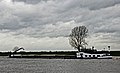 Barge on the Maas
 -
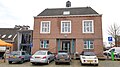 Former town hall


.jpg)

References
- ^ a b c "Kerncijfers wijken en buurten 2021". Central Bureau of Statistics. Retrieved 18 April 2022.
two entries
- ^ "Postcodetool for 5397AA". Actueel Hoogtebestand Nederland (in Dutch). Het Waterschapshuis. Retrieved 18 April 2022.
- ^ "Lith - (geografische naam)". Etymologiebank (in Dutch). Retrieved 18 April 2022.
- ^ ISBN 90 400 9945 6. Retrieved 18 April 2022.
- ^ "Zeldenrust". Molen database (in Dutch). Retrieved 18 April 2022.
- ^ "Lith". Plaatsengids (in Dutch). Retrieved 18 April 2022.
External links
 Media related to Lith at Wikimedia Commons
| Authority control databases: National |
|---|