
Little Rock, Kentucky
Little Rock, Kentucky | |
|---|---|
UTC-4 (EDT) | |
| Area code | 859 |
| GNIS feature ID | 496843[1] |
Little Rock is an
References
- ^ "Little Rock". Geographic Names Information System. United States Geological Survey, United States Department of the Interior.
- ^ State Primary Road System: Bourbon County (PDF) (Map). Kentucky Transportation Cabinet. 2012. Retrieved April 30, 2013.
Municipalities and communities of Bourbon County, Kentucky, United States | ||
|---|---|---|
| Cities | 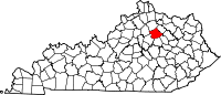 | |
| Unincorporated communities | ||
| ||
This Bourbon County, Kentucky state location article is a stub. You can help Wikipedia by expanding it. |