
Loch Quoich
| Loch Quoich | |
|---|---|
 Looking south west to Sgurr Mòr in the distance | |
 Loch Quoich | |
| Location | Lochaber, Scotland |
| Coordinates | 57°04′N 5°17′W / 57.067°N 5.283°W |
| Type | reservoir, loch |
| Basin countries | United Kingdom |
Loch Quoich (Scottish Gaelic: Loch Chuaich) is a loch and reservoir situated west of Loch Garry approximately 40 km northwest of Fort William, Lochaber, Scotland. The name means "loch of the quaich". In 1896, it was listed as six miles long and three-quarters of a mile in width, belonging to Mrs. Ellice of Glenquoich, within the parish of Kilmonivaig.[1]
Both lochs form part of the Glen Garry hydroelectricity project commissioned by the North of Scotland Hydro-Electric Board in the 1950s.[2]
The scheme was completed in 1962.
Geology
The Loch Quoich Line is a
On 10 November 2018, a landslide at Loch Quoich near Kinloch Hourn destroyed a pylon and knocked out power for 20,000 homes; telephones service was also interrupted.[5] The landslide, which dislocated 9,000 tonnes, blocked road access until mid-2019.[6]
Gallery
-
 Loch Quoich from Spidean Mialach
 -
 Loch Quoich from the roadside, looking west
 -
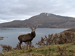 Stag at Loch Quoich


See also
- List of reservoirs and dams in the United Kingdom
References
- ^ The Fishing Gazette: Devoted to Angling, River, Lake, and Sea Fishing, and Fish Culture. Charles William Bradley & Company. 1896. p. 333.
- ^ "Loch Quoich Dam | Canmore". canmore.org.uk. Retrieved 26 November 2022.
- S2CID 128852995.
- S2CID 53689649.
- ^ Kempe, Nick (2 November 2021). "On landslides and their impact - lessons from Loch Quoich for the A83 and SSE's green credentials". parkswatchscotland. Retrieved 26 November 2022.
- ^ Petley, Dave (18 December 2018). "Loch Quoich landslide: an interesting and disruptive failure in the Highlands of Scotland". The Landslide Blog. Retrieved 26 November 2022.
External links
 Media related to Loch Quoich at Wikimedia Commons