
Mavrovo Lake
| Mavrovo | |
|---|---|
Republic of Macedonia | |
| Max. length | 10 km (6.2 mi) |
| Max. width | 5 km (3.1 mi) |
| Surface area | 1,370 ha (3,400 acres) |
| Max. depth | 50 m (160 ft) |
| Water volume | 357 hm3 (289,000 acre⋅ft) |
 | |
Mavrovo Lake (
Republic of Macedonia, less than 100 km from Skopje. It is an important tourist destination, being frequented for recreational activities such as swimming, boating and trout fishing during the summer; a distinctive building in the lake is the half-submerged church of Saint Nicholas. Since 1952 it is part of the Mavrovo National Park
. With its surface of 13.7 km2 (3,400 acres), is one of the most extensive artificial lakes of the country.
The lake is surrounded by the Šar Mountains on the North and the Bistra Mountains on the South, both exceeding heights of 2000 m.
Gallery
-
 View of the lake in winter
 -
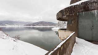 Watchtower at the dam
 -
 Watchtower at the dam


References
Wikimedia Commons has media related to Mavrovo Lake.