
Maxville, Montana
Maxville, Montana | |
|---|---|
UTC-6 (MDT) | |
| Area code | 406 |
| GNIS feature ID | 2583829[2] |
Maxville is a
.Geography
Maxville is located at 46°27′53″N 113°14′03″W / 46.46472°N 113.23417°W. According to the
U.S. Census Bureau, the community has an area of 6.924 square miles (17.93 km2), of which 6.915 square miles (17.91 km2) is land and 0.009 square miles (0.023 km2) is water.[3]
Demographics
| Census | Pop. | Note | %± |
|---|---|---|---|
| 2020 | 138 | — | |
| U.S. Decennial Census[4] | |||
References
- ^ "ArcGIS REST Services Directory". United States Census Bureau. Retrieved September 5, 2022.
- ^ a b "Maxville". Geographic Names Information System. United States Geological Survey, United States Department of the Interior.
- ^ U.S. Census Bureau. Retrieved April 24, 2016.
- ^ "Census of Population and Housing". Census.gov. Retrieved June 4, 2016.
Municipalities and communities of Granite County, Montana, United States | ||
|---|---|---|
| Towns | 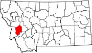 | |
| CDPs | ||
Unincorporated communities | ||
| Ghost towns | ||
| ||
This Granite County, Montana state location article is a stub. You can help Wikipedia by expanding it. |