
Midagahara


Midagahara (弥陀ヶ原, Midaga-hara) is a wetlands located near
Ramsar Site in 2012.[1]
Midagahara is a one of many highlights of Tateyama Kurobe Alpine Route.
Geography

Midagahara is 2 km of Horizontal length and 4 km of vertical length.
Midagahara is a lava plateau formed by Tateyama volcano.[2]
Biota
There are Dactylorhiza aristata, Paris japonica, Lysichiton camtschatcensis, Daylily.
Facility
There are some Hotels.
-
 TATEYAMA SOU of National youth hostels
 -
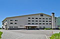 Midagahara Hotel
 -
 Midagahara bus stop


,_bun_stop.jpg)
Access
There are Midagahara bus stops between Bijodaira Station and Murodō Station on Tateyama Kurobe Alpine Route.
Private cars aren't allowed to pass in Midagahara to protect the environment.
See also
- List of volcanoes in Japan
- List of lakes in Japan
References
- ^ ラムサール条約湿地の新規登録について 富山県
- ^ 野崎保、菊川茂:立山カルデラの形成と深層崩壊の歴史 -鳶泥と国見泥- 日本地すべり学会誌 Vol.49(2012) No.4 p.196-203