
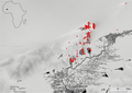
Middle Niger
The Middle Niger is a region of
Dia
The settlement complex at Dia consists of an agglomeration of three separate large archaeological sites: Dia-Shoma, Dia, and Dia-Mara. With an area of 49ha, Dia-Shoma is the largest and oldest, dating back to the 9th century BCE.[3]
.jpg)
Djenné-Djenno
The civilization of

Macina
Macina is a small town and rural commune in the Cercle of Macina in the Ségou Region of southern-central Mali. The commune covers an area of 1,100 square kilometers and contains the main town and 20 villages.[6]
Malian Lakes Region

The
The Malian Lakes Region sites share connections with Tichitt Tradition sites via one of its categorized sites.[7] Tell-type site pottery of the Malian Lakes Region also is similar in appearance (e.g., folded strip roulettes, thickened rims) to Faïta pottery.[7] In total, there are 180 villages, hamlets, and many types of stone structures and enclosures.[7] Among the total constructed stone villages, 30 stone villages may have evidence of concessions with stone pillar structures in them; there is also Fati 6 where a drystone tell is of an intermediary architectural status between the earlier drystone structures in the escarpment region and the later drystone structures of the Tondidarou region; both show close resemblance and apparent connection with the architectural structures of the Tichitt culture.[7] The Malian Lakes Region and the Mauritanian Tichitt cultural region bear strong geographic resemblance (e.g., escarpments) and similar complex settlement patterns on and below the escarpments.[7] In the Malian Lakes Region, the stone villages may have been constructed between the 2nd millennium BCE and the 1st millennium BCE.[7] In 1st millennium CE, earthen tells were created in the plains, along the shoresides and in floodplains of the Niger River at Tondidarou; the difference in distance and dates may indicate that there was gradual change in settlement sites, from the regional section of the Malian Lake Region where the escarpments are located toward the regional section where Tondidarou is located, as well as gradual technical shift toward construction of earthen settlement mounds.[7] Altogether, the archaeological evidence on and below the Malian Lakes Region escarpments of the 2nd millennium BCE - 1st millennium BCE may serve as connective evidence between Mema, Tondidarou and other Middle Niger sites of the 1st millennium CE, and the Tichitt Tradition of Mauritania.[7]
-
 Map and satellite image
 -
 Field boundary on the western shore of Lake Fati
 -
 Location densities of sites, showing clear preferences for sandstone escarpments. Permanent water (1984–2021) in black, impermanent water in grey.
 -
 Location of documented sites. Permanent water (1984–2021) in black, impermanent water in grey.
 -
 Possible pillar structures in village sites of the Mali Lakes Region


Méma
Toladié, which dates between at least 430 CE and 670 CE, is the largest occupation site (76 hectares) in
At the Akumbu mound complex, in Mema, its findings date between 400 CE and 1400 CE; at the cultural deposit of AK3, which contained three human remains, the dates range between 400 CE and 600 CE.
References
- S2CID 161938622.
- S2CID 161053129.
- ^ a b Arazi, Noemie. "Tracing History in Dia, in the Inland Niger Delta of Mali -Archaeology, Oral Traditions and Written Sources" (PDF). Institute of Archaeology.
- ^ ISBN 9781443845793.
- ISBN 978-0-19-938465-5.
- ^ Communes de la Région de Ségou (PDF) (in French), Ministère de l’administration territoriale et des collectivités locales, République du Mali, archived from the original (PDF) on 2012-03-09.
- ^ .
- ISBN 978-0-19-162614-2.
- ISBN 9781461705925.
- ^ S2CID 129143321.