Millard Airport (Nebraska)
41°11′46″N 096°06′44″W / 41.19611°N 96.11222°W
Millard Airport | |||||||||||
|---|---|---|---|---|---|---|---|---|---|---|---|
AMSL 1,051 ft / 320 m | | ||||||||||
| Map | |||||||||||
| Runways | |||||||||||
| |||||||||||
| Statistics (2021) | |||||||||||
| |||||||||||
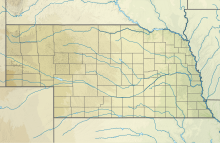
Millard Airport (IATA: MIQ, ICAO: KMLE, FAA LID: MLE) is a public airport seven miles (11 km) southwest of the central business district of Omaha, a city in Douglas County, Nebraska, United States. It is owned and operated by the Omaha Airport Authority,[1] who also owns the main airport of Omaha, Eppley Airfield.
Although most US airports use the same three-letter
Facilities and aircraft
Millard Airport covers an area of 165 acres (67 ha) which contains one asphalt-paved runway (12/30) measuring 3,801 x 75 ft (1,159 × 23 m). For the 12-month period ending September 20, 2021, the airport had 24,000 aircraft operations, an average of 66 per day: 94% general aviation, 6% air taxi and <1% military. There was at the time 125 aircraft based at this airport: 115 single-engine, 9 multi-engine, and 1 glider.[1]
See also
References
- ^ PDF, effective September 7, 2023
- ^ Great Circle Mapper: MIQ / KMLE – Omaha, Nebraska (Millard Airport)
- ^ Great Circle Mapper: MLE / VRMM – Malé, Hulhulé, Maldives
External links
- Millard Airport at Nebraska Department of Aeronautics
- Resources for this airport:
- FAA airport information for MLE
- AirNav airport information for KMLE
- ASN accident history for MIQ
- FlightAware airport information and live flight tracker
- NOAA/NWS weather observations: current, past three days
- SkyVector aeronautical chart, Terminal Procedures


