
Moerbeke
This article needs additional citations for verification. (March 2013) |
Moerbeke | ||
|---|---|---|
 | ||
 Flag  Coat of arms | ||
Location of Moerbeke  | ||
 Moerbeke Location in Belgium
Location of Moerbeke in East Flanders Region Flemish Region | | |
| Province | ||
| Arrondissement | Ghent | |
| Government | ||
| • Mayor | Robby De Caluwé (Open Vld) | |
| • Governing party/ies | Open Vld | |
| Area | ||
• Total | 37.93 km2 (14.64 sq mi) | |
| Population (2018-01-01)[1] | ||
• Total | 6,455 | |
| • Density | 170/km2 (440/sq mi) | |
| Postal codes | 9180 | |
| NIS code | 44045 | |
| Area codes | 09, 03 | |
| Website | www.moerbeke.be | |
Moerbeke (Dutch pronunciation: [ˈmuːrbeːkə]) is a former municipality in the Belgian province of East Flanders. It is sometimes unofficially called Moerbeke-Waas (Dutch pronunciation: [ˌmuːrbeːkə ˈʋaːs]) to distinguish between this place and Moerbeke in Geraardsbergen.[2] The municipality comprises the town of Moerbeke proper, and part of the Dutch-Belgian village Koewacht.[3] In 2021, Moerbeke had a total population of 6,619. The total area is 37.80 km².[4]
Moerbeke was known very well for its sugar refinery.
It is thought to have been the hometown of William of Moerbeke, who as Bishop of Corinth produced a new translation into Latin of the works of Aristotle, including certain which had been rediscovered from Arab sources, in the late 13th century.
Unique is the political situation: since 1847 the
The
The members of the council are Frederic Dierinck, Inge Mertens, Koen Mertens and Jonas Vandamme for Open Vld, Steven Aper for
Sports
The local sports area is located north of the town center. It includes soccer club KFC Moerbeke, a sports hall, tennis club TC Moerbeke, and a scouting facility.
Gallery
-
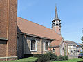
 Moerbeke, church: parochiekerk Sint Antonius Abt
 -
 Moerbeke, drawing bridge across de Moervaart
 -
 Koewacht-Moerbeke, church: de Sint Filippus en Sint Jacobuskerk


References
- ^ "Wettelijke Bevolking per gemeente op 1 januari 2018". Statbel. Retrieved 9 March 2019.
- ^ "Algemene info: Cijfers en weetjes". www.moerbeke.be. Gemeente Moerbeke. Archived from the original on 4 March 2016. Retrieved 3 February 2015.
- ^ "Moerbeke". Agentschap Onroerend Erfgoed (in Dutch). Retrieved 9 May 2022.
- ^ "Bevolking per statistische sector - Sector 44045". Statistics Belgium. Retrieved 9 May 2022.
External links
 Media related to Moerbeke at Wikimedia Commons
- Official website (in Dutch)
- The mayor's website (in Dutch)
- Open Vld Moerbeke's website (in Dutch)
Places adjacent to Moerbeke | ||||||||||||||||
|---|---|---|---|---|---|---|---|---|---|---|---|---|---|---|---|---|
| ||||||||||||||||
| International | |
|---|---|
| National | |
| Geographic | |
This East Flanders location article is a stub. You can help Wikipedia by expanding it. |