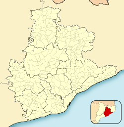
Montclar, Berguedà
Montclar | |
|---|---|
 | |
 Map showing location within Berguedà | |
| Coordinates: 42°01′13″N 1°45′54″E / 42.02028°N 1.76500°E | |
| Country | |
| Community | |
| Province | Barcelona |
| Comarca | Berguedà |
| Government | |
| • Mayor | Raquel Sala Prat (2015)[1] (M-AM) |
| Area | |
| • Total | 21.9 km2 (8.5 sq mi) |
| Elevation | 728 m (2,388 ft) |
| Population (2018)[3] | |
| • Total | 129 |
| • Density | 5.9/km2 (15/sq mi) |
| Demonym(s) | Montclarenc, montclarenca |
| Website | www |
Montclar (Catalan pronunciation: exclave to the north-east.
History
The town first appears in written documentation in the year 1117. In 1240, King James I of Aragon granted the land to Pere de Breda, though by 1309, it was once again a possession of the crown.
Culture
The municipality's parochial church, in the
baroque altar and other neoclassical
elements in the interior. The church was completely renovated in 1970.
The municipality has several other extant churches, including the Church of the Santa Creu, and, notably, the Church of Sant Quintí. This barrel-vaulted structure had its 11th century reliquary removed to the Diocesan Museum of Solsona.
Montclar's town festival is celebrated in January, to coincide with the feast day of Saint Sebastian.
Economy
cereals
.
References
- Generalitat of Catalonia. Retrieved 2015-11-13.
- Statistical Institute of Catalonia. Retrieved 2015-11-23.
- ^ Municipal Register of Spain 2018. National Statistics Institute.
External links
- Government data pages (in Catalan)


