Moozhiyar Dam
This article needs additional citations for verification. (July 2021) |
| Moozhiyar Dam | |
|---|---|
 | |
| Country | India |
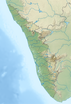
| Location | Pathanamthitta, Kerala |
| Coordinates | 9°18′29″N 77°03′56″E / 9.3080°N 77.0656°E |
| Purpose | Power |
| Status | Operational |
| Opening date | 1999 |
| Owner(s) | Kerala State Electricity Board |
| Dam and spillways | |
| Type of dam | Gravity dam |
| Impounds | Kakkattar |
| Height (foundation) | 30.04 m (98.6 ft) |
| Length | 176.5 m (579 ft) |
| Elevation at crest | 186.53 m (612.0 ft) |
| Width (crest) | 6.40 m (21.0 ft) |
| Dam volume | ‹See Tfd› ≈ 52,160 m3 (1,842,000 cu ft) |
Annual generation | 262 MU |
| Website KSEB - Official website | |
Moozhiyar Dam is a gravity dam located close to Kakki reservoir in Seethathodu panchayath of Pathanamthitta district in Kerala, India. The Kakkad Hydroelectric Project is powered by water from the dam.[1] The water level is set at 192.5 meters. KSEB is responsible for the maintenance of the dam and other ancillary works. The Kakkad Hydroelectric Project generates 50 MW of electricity using 2 turbines of 25 MW each year.[2] The annual output is 262 MU. The machine was commissioned on 16 September 1999. Kakkad Hydro electric Project is the second stage development of Pamba river basin. The installed capacity is 50 MW (2 x 25MW). This scheme utilises the tail race water from Sabarigiri power station and flow received from Moozhiyar and Velluthode rivers. Two dams feed water to the powerhouse. The Moozhiyar Dam creates the main reservoir of this project.[3] Taluks through which release flow are Ranni, Konni, Kozhencherry, Thiruvalla, Chengannur, Kuttanadu, Mavelikara and Karthikappally.[4]
Specifications
- Panchayath : Seethathodu
- Village :Seethathodu
- District : Pathanamthitta
- River Basin :Pamba
- River: Kakkad ar
- Release from Dam to river : Kakkad Ar
- Year of completion : 1999
- Type of Dam : Concrete – Gravity
- Classification: HH- ( High Height)
- Maximum Water Level (MWL) : EL 192.94 m
- Full Reservoir Level ( FRL) : EL 192.63 m
- Storage at FRL : 1.50 Mm3
- Height from deepest foundation : 30.04 m
- Length : 176.5 m
- Spillway : 3 Nos. radial gates, each of size 7.62×6.70 m
Reservoir
Size of the Water Spread Area is 0.1457 km2 and the Full Reservoir Level (FRL) is at 192.63 m. Minimum Drawdown level (MDDL) is 181.36 m and Effective Storage at FRL is at 1.16 MCM[5] Sabari giri Power Station commissioned during 1966 -67 with six generators having vertical shaft pelton turbine as the prime mover. After power generation, water from the power station is released to the Moozhiyar reservoir[citation needed]
References
- ^ മൂഴിയാർ ഡാമിൻറെ ഷട്ടറുകൾ തുറക്കും | Moozhiyar dam, retrieved 21 July 2021
- ^ "Kerala State Electricity Board Limited - Pamba Basin HydroProjects". www.kseb.in. Retrieved 26 July 2021.
- ^ "Kerala State Electricity Board Limited - Pamba Basin HydroProjects". www.kseb.in. Retrieved 21 July 2021.
- ^ "MOOZHIYAR DAM – KSEB Limted Dam Safety Organisation". Retrieved 26 July 2021.
 This article incorporates text available under the CC BY-SA 2.5 license.
- ^ "Kerala State Electricity Board Limited - Pamba Basin HydroProjects". www.kseb.in. Retrieved 7 July 2021.


