
Moravian-Silesian Foothills
| Moravian-Silesian Foothills | |
|---|---|
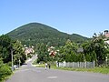
 View towards Ondřejník | |
| Highest point | |
| Peak | Skalka |
| Elevation | 964 m (3,163 ft) |
| Dimensions | |
| Length | 92 km (57 mi) |
| Area | 1,508 km2 (582 sq mi) |
| Geography | |
 Moravian-Silesian Foothills, marked in red and labeled as D1
| |
| Country | Czech Republic |
| Region | Moravian-Silesian, Olomouc, Zlín |
| Range coordinates | 49°33′N 18°3′E / 49.550°N 18.050°E |
| Parent range | Western Beskidian Foothills |
| Geology | |
| Type of rock | Flysch, sedimentary rock |
Moravian-Silesian Foothills (Czech: Podbeskydská pahorkatina) are foothills and a geomorphological mesoregion of the Czech Republic.
Geomorphology
The Moravian-Silesian Foothills is a
There are a lot of low mountains or high hills. The highest peaks of the Moravian-Silesian Foothills are:
- Skalka, 964 m (3,163 ft)
- Stanovec, 899 m (2,949 ft)
- Ondřejník, 890 m (2,920 ft)
- Suché úbočí, 864 m (2,835 ft)
- Červený kámen, 695 m (2,280 ft)
- Kubánkov, 660 m (2,170 ft)
- Opálená, 641 m (2,103 ft)
- Holý vrch, 631 m (2,070 ft)
- Babí hora, 619 m (2,031 ft)
- Ostružná, 616 m (2,021 ft)
Geography
Moravian-Silesian Foothills are located in the east of the Czech Republic. The territory has an elongated shape, stretching from west to east. Most of the foothills lie in the Moravian-Silesian Region, about one third lies in the Olomouc Region, and a small southwestern part extends into the Zlín Region. The area of the foothills is 1,508 km2 (582 sq mi) and the average height is 353 metres (1,158 ft).[2]
The most important rivers are the
The most populated settlements which lie entirely in the territory are Třinec, Český Těšín, Nový Jičín and Kopřivnice. The cities of Frýdek-Místek and Přerov and the town of Valašské Meziříčí are also partly located there.
Gallery
-
 Skalka, the highest mountain
 -
 View from Loučka (Vsetín District) to the north
 -
 Červený kámen


See also
References
- ^ "Podbeskydská pahorkatina". moravske-karpaty.cz (in Czech). 2015-01-08. Retrieved 2023-04-06.
- ^ "Geomorfologicé celky ČR, pořadí podle rozlohy" (in Czech). Treking.cz. 2009-12-15. Retrieved 2023-04-06.
| Authority control databases: National |
|---|