
Mount Samat
| Mount Samat | |
|---|---|
 Mount Samat remote view | |
| Highest point | |
| Elevation | 560 m (1,840 ft)[1] |
| Prominence | 218 m (715 ft) |
| Parent peak | Mount Mariveles |
| Coordinates | 14°36′15.4″N 120°30′27.3″E / 14.604278°N 120.507583°E |
| Geography | |
.svg) Mount Samat Location within the Philippines | |
| Location | Luzon |
| Country | Philippines |
| Region | Central Luzon |
| Province | Bataan |
| Municipality | Pilar |
| Parent range | Zambales Mountains |
| Geology | |
| Mountain type | Extinct volcano |
| Volcanic arc/belt | Western Bataan Lineament |
| Last eruption | Unknown |
| Climbing | |
| Easiest route | Mt. Samat Road[1] |
Mount Samat (Tagalog pronunciation: [samat]) is a mountain in the town of Pilar, Bataan, Philippines. Located near its summit is the Mount Samat National Shrine, a national shrine dedicated to the fallen Filipino and American fallen during World War II.
Geology
Mount Samat is a parasitic cone of Mount Mariveles with no record of historical eruption. The summit of Mount Samat is 9.2 km (5.7 mi) NNE of the Mariveles caldera.[2] Mount Samat itself has a 550-metre (1,800 ft) wide crater that opens to the northeast. The Mount Samat Cross is situated near the edge of the crater rim.[1]
Historical significance

At the start of
The Mount Samat National Shrine was erected as a memorial to the Filipino and American soldiers who fought against the Imperial Japanese Army in World War II.[3]
Dunsulan Falls
Dunsulan Falls (14°36′52.7″N 120°29′33.8″E / 14.614639°N 120.492722°E) is a waterfall located at the foot of Mount Samat, northeast of the National Shrine in Brgy Liyang, also in Pilar town.[4] Dunsulan falls and river is the main drainage on the crater side of Mount Samat.
Images
-
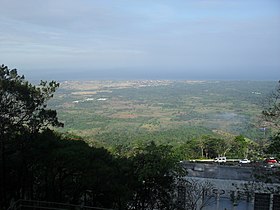 View from Mount Samat

References
- ^ a b c "Mount Samat, Cantral Luzon, Philippines". Google Maps. Retrieved on June 8, 2012.
- ^ "Mariveles Synonyms & Subfeatures". Global Volcanism Program. Retrieved on June 8, 2012.
- ^ Government of Province of Bataan (2006)."Dambana ng Kagitingan" Archived March 18, 2012, at the Wayback Machine. Bataan...A Raging Peninsula. Retrieved on March 27, 2011.
- ^ "Historical trails: Mt. Samat". Pinoy Mountaineer. Retrieved June 8, 2012.
External links
- Photo of Dunsulan Falls from Panoramio