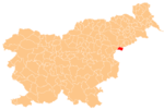
Municipality of Rogatec
Municipality of Rogatec
Občina Rogatec | |
|---|---|
 | |
|
UTC+02 (CEST) | |
| Website | www |
The Municipality of Rogatec (pronounced Styria. It is now included in the Savinja Statistical Region.[2] The municipality was established in its current form on 3 October 1994, when the former larger Municipality of Šmarje pri Jelšah was subdivided into the municipalities of Kozje, Podčetrtek, Rogaška Slatina, Rogatec, and Šmarje pri Jelšah.[3]
Settlements
In addition to the municipal seat of Rogatec, the municipality also includes the following settlements:
References
External links
 Media related to Municipality of Rogatec at Wikimedia Commons
- Municipality of Rogatec on Geopedia
- Municipality of Rogatec website

