
Ogden River
The Ogden River is a 35-mile (56 km) long river in Weber County. Utah, United States.[1]
Description
The Ogden River's three forks (North, Central, and South) begin in the
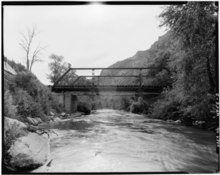
Pineview Reservoir, near Huntsville. The river then flows southwest through Ogden Canyon, the city of Ogden, and the border of West Haven and Marriott-Slaterville where it joins the Weber River
.
The Ogden River is older than the Wasatch Mountains. As the mountains slowly rose over the last 15 million years by periodic faulting on the Wasatch fault, the river was able to cut through the landscape to create the remarkable Ogden Canyon, which is a roughly 6-mile (9.7 km) long canyon with a series of smaller side canyons.[2] The city of Ogden is at the western end of Ogden Canyon, with the eastern end at Pineview Dam.
Originally named after 19th-century fur trader
Bureau of Reclamation as part of the Ogden River Project. This project attempts to supply irrigation to 25,000 acres (100 km2) of nearby land. Other related projects include the Ogden-Brigham Canal, which connects the river with Brigham City to the north, the reconstructed Ogden Canyon Conduit, and the South Ogden Highline Canal.[4]
See also
References
- ^ U.S. Geological Survey Geographic Names Information System: Ogden River
- ISBN 0-300-08423-4. p. 448.
- ^ The Columbia Gazetteer of North America. 2000. Columbia University Press.
- ^ Ogden River Project, General Description Archived 2006-06-14 at the Wayback Machine. Bureau of Reclamation. Retrieved on July 18, 2006.
External links
![]() Media related to Ogden River at Wikimedia Commons
Media related to Ogden River at Wikimedia Commons