
Parshall, Colorado
Parshall, Colorado | |
|---|---|
MDT) | |
| ZIP Code[4] | 80468 |
| Area code | 970 |
| GNIS feature | 2583276[1] |
Parshall is an
United States Census 2020, the population of the Parshall CDP was 42.[3]
Demographics
The
United States Census 2010
.
| Year | Pop. | ±% |
|---|---|---|
| 2010 | 47 | — |
| 2020 | 42 | −10.6% |
| Source: United States Census Bureau | ||
Commerce and industry
The Henderson MillCattle ranching occupies much of the lower areas.
Geography
Parshall is located along the south side of U.S. Route 40 between Hot Sulphur Springs and Kremmling, on the north bank of the Colorado River downstream from Byers Canyon.
The Parshall CDP has an area of 191 acres (0.774 km2), all land.[2]
Climate
This climate type is dominated by the winter season, a long, bitterly cold period with short, clear days, relatively little precipitation mostly in the form of snow, and low humidity. According to the
Köppen Climate Classification system, Parshall has a subarctic climate, abbreviated "Dfc" on climate maps.[8]
| Climate data for Williams Fork Dam, Colorado, 1991–2020 normals, extremes 1982–present | |||||||||||||
|---|---|---|---|---|---|---|---|---|---|---|---|---|---|
| Month | Jan | Feb | Mar | Apr | May | Jun | Jul | Aug | Sep | Oct | Nov | Dec | Year |
| Record high °F (°C) | 53 (12) |
56 (13) |
67 (19) |
76 (24) |
84 (29) |
90 (32) |
92 (33) |
90 (32) |
88 (31) |
79 (26) |
65 (18) |
59 (15) |
92 (33) |
| Mean maximum °F (°C) | 43.8 (6.6) |
47.1 (8.4) |
57.7 (14.3) |
68.0 (20.0) |
76.7 (24.8) |
83.7 (28.7) |
87.6 (30.9) |
85.4 (29.7) |
81.1 (27.3) |
72.8 (22.7) |
57.7 (14.3) |
46.6 (8.1) |
87.6 (30.9) |
| Mean daily maximum °F (°C) | 25.9 (−3.4) |
31.1 (−0.5) |
42.3 (5.7) |
52.1 (11.2) |
62.1 (16.7) |
73.1 (22.8) |
79.2 (26.2) |
77.1 (25.1) |
70.1 (21.2) |
56.9 (13.8) |
41.0 (5.0) |
28.2 (−2.1) |
53.3 (11.8) |
| Daily mean °F (°C) | 13.0 (−10.6) |
17.4 (−8.1) |
28.5 (−1.9) |
37.9 (3.3) |
46.9 (8.3) |
55.8 (13.2) |
61.9 (16.6) |
60.1 (15.6) |
52.5 (11.4) |
41.0 (5.0) |
27.9 (−2.3) |
15.8 (−9.0) |
38.2 (3.5) |
| Mean daily minimum °F (°C) | 0.1 (−17.7) |
3.7 (−15.7) |
14.6 (−9.7) |
23.7 (−4.6) |
31.7 (−0.2) |
38.4 (3.6) |
44.5 (6.9) |
43.0 (6.1) |
34.9 (1.6) |
25.1 (−3.8) |
14.7 (−9.6) |
3.5 (−15.8) |
23.2 (−4.9) |
| Mean minimum °F (°C) | −20.6 (−29.2) |
−17.3 (−27.4) |
−6.0 (−21.1) |
9.7 (−12.4) |
20.2 (−6.6) |
28.6 (−1.9) |
36.2 (2.3) |
34.6 (1.4) |
23.1 (−4.9) |
9.7 (−12.4) |
−5.6 (−20.9) |
−16.3 (−26.8) |
−24.1 (−31.2) |
| Record low °F (°C) | −33 (−36) |
−44 (−42) |
−25 (−32) |
−9 (−23) |
12 (−11) |
20 (−7) |
30 (−1) |
23 (−5) |
11 (−12) |
−9 (−23) |
−23 (−31) |
−32 (−36) |
−44 (−42) |
| Average precipitation inches (mm) | 1.00 (25) |
0.95 (24) |
0.98 (25) |
1.46 (37) |
1.53 (39) |
0.99 (25) |
1.44 (37) |
1.44 (37) |
1.40 (36) |
1.26 (32) |
0.92 (23) |
0.88 (22) |
14.25 (362) |
| Average snowfall inches (cm) | 14.2 (36) |
13.6 (35) |
10.4 (26) |
11.9 (30) |
2.7 (6.9) |
0.1 (0.25) |
0.0 (0.0) |
0.0 (0.0) |
0.3 (0.76) |
4.8 (12) |
9.9 (25) |
13.3 (34) |
81.2 (205.91) |
| Average precipitation days (≥ 0.01 in) | 10.1 | 9.9 | 8.0 | 9.8 | 9.7 | 6.8 | 9.4 | 10.3 | 8.3 | 7.5 | 8.4 | 9.1 | 107.3 |
| Average snowy days (≥ 0.1 in) | 7.6 | 7.7 | 5.5 | 4.8 | 1.3 | 0.1 | 0.0 | 0.0 | 0.2 | 2.3 | 5.8 | 7.2 | 42.5 |
| Source 1: NOAA[9] | |||||||||||||
| Source 2: National Weather Service[10] | |||||||||||||
See also
References
- ^ a b c d U.S. Geological Survey Geographic Names Information System: Parshall, Colorado
- ^ a b "State of Colorado Census Designated Places - BAS20 - Data as of January 1, 2020". United States Census Bureau. Retrieved December 22, 2020.
- ^ a b United States Census Bureau. "Parshall CDP, Colorado". Retrieved April 15, 2023.
- ^ a b "Look Up a ZIP Code". United States Postal Service. Retrieved December 19, 2020.
- ^ ClimaxMoly: USA - Colorado - Henderson Archived June 30, 2014, at the Wayback Machine
- ^ grow school colorado cannabis near denver
- ^ Colorado Dude Ranch Colorado Guest Ranch Breckenridge CO Dude Ranch Breckenridge Colorado Guest Ranch Aspen Canyon Ranch
- ^ Climate Summary for Parshall, Colorado
- ^ "U.S. Climate Normals Quick Access". National Oceanic and Atmospheric Administration. Retrieved September 11, 2022.
- ^ "NOAA Online Weather Data". National Weather Service. Retrieved September 11, 2022.
External links
Parshall, Colorado at Wikipedia's sister projects
 Definitions from Wiktionary
 Media from Commons
 News from Wikinews
 Quotations from Wikiquote
 Texts from Wikisource
 Textbooks from Wikibooks
 Resources from Wikiversity
- Parshall @ Colorado.com
- Parshall @ UncoverColorado.com
- History of Parshall
- Parshall, Colorado Mining Claims And Mines
- Grand County website
Municipalities and communities of Grand County, Colorado, United States | ||
|---|---|---|
| Towns | 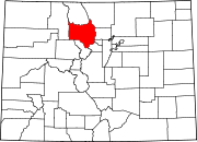 | |
| CDPs | ||
| Unincorporated communities | ||
| Ghost towns | ||
| ||