Pataua River
| Pataua River | |
|---|---|
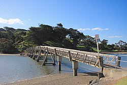
 Footbridge over the Pataua River | |
| Native name | Pataua (Māori) |
| Location | |
| Country | New Zealand |
| Region | Northland Region |
| District | Whangarei District |
| Physical characteristics | |
| Mouth | |
• location | Ngunguru Bay |
• coordinates | 35°42′50″S 174°31′35″E / 35.71389°S 174.52639°E |
| Length | 10 km (6 mi) |
The Pataua River is a
Pataua South, which are connected by a footbridge
.
See also
References
"Place name detail: Pataua River". New Zealand Gazetteer. New Zealand Geographic Board. Retrieved 12 July 2009.
