
Pathum Wan district
Pathum Wan
ปทุมวัน | |
|---|---|
 The Siam area, with Siam Square in the foreground | |
 Location in Bangkok | |
| Coordinates (district office): 13°44′42″N 100°31′20″E / 13.74500°N 100.52222°E | |
| Country | Thailand |
| Province | Bangkok |
| Seat | Rong Mueang |
| Khwaeng | 4 |
| Area | |
| • Total | 8.37 km2 (3.23 sq mi) |
| Population (2019) | |
| • Total | 47,685 |
| • Density | 5,700/km2 (15,000/sq mi) |
| Postal code | 10330 |
| Geocode | 1007 |
Pathum Wan (
History
When King
By the reign of King
Sometime before 1855, Mongkut had part of the royal fields south of the canal landscaped with ponds and waterways, which were planted with decorative lotuses, for leisurely visits. A royal villa was built there, which was named Pathum Wan, meaning "lotus forest" (from
.jpg)
With the royal development, the area began to attract more residents, and more palaces were built during the following reign of King Chulalongkorn (Rama V, 1868–1910). The King had a palace built for Prince Svasti Sobhana west of Pathum Wan Palace in 1880, and commissioned Windsor Palace in 1881 for his own son Prince Vajirunhis, buying up large amounts of land for what was to be its extensive grounds.[3] He also later gifted a plot of land to another son, Prince Mahidol Adulyadej, though it was Mahidol's mother Queen Savang Vadhana who oversaw the construction Sa Pathum Palace there after Chulalongkorn died in 1910.[2]
Windsor Palace had become vacant following Vajirunhis's death in 1895, and its grounds became the site of several successive educational institutions which became established as
Pathum Wan District saw increasing development throughout the 20th century, especially since the 1970s when the area along Rama I and Phloenchit roads became developed as a major shopping and commercial district. The
Geography and administration
Pathum Wan District occupies 8.369 square kilometres (3.231 sq mi) in Bangkok's Phra Nakhon side (east of the Chao Phraya River). It is bordered by Dusit and Ratchathewi districts to the north across Khlong Saen Saep, Watthana and Khlong Toei to the east across the Maenam railway, Sathon and Bang Rak to the south across Rama IV Road, and Pom Prap Sattru Phai to the west across Khlong Phadung Krung Kasem.

The district is served by two major thoroughfares running roughly west–east: Rama I–Phloen Chit near Saen Saep Canal and Rama IV Road along the district's southern edge. They are crossed by several roads running north–south: Rama VI–Charu Mueang,
Banthat Thong, Phaya Thai and Ratchadamri roads divide the district into four subdistricts (khwaeng). They are, from east to west: Rong Mueang, Wang Mai, Pathum Wan and Lumphini. Together, they have a registered population of 47,685 as of October 2019.[7]
| Name | Area (km2) | Population (2019) | ||
|---|---|---|---|---|
| 1. | Rong Mueang | รองเมือง | 1.423 | 16,827 |
| 2. | Wang Mai | วังใหม่ | 1.423 | 6,877 |
| 3. | Pathum Wan | ปทุมวัน | 2.276 | 6,022 |
| 4. | Lumphini | ลุมพินี | 3.247 | 17,959 |
Neighbourhoods
Rong Mueang remains the district's least developed area, occupied mostly by low-rise residential neighbourhoods. Rama VI Road crosses Rama I at Phong Phraram Intersection, and becomes known as Charu Mueang Road towards Rama IV to the south. The subdistrict's most prominent landmark is the Bangkok Railway Station (commonly known as Hua Lamphong), which lies in its southwestern corner at Hua Lamphong Intersection; the railway yard occupies most of the area along Phadung Krung Kasem Canal.
The area of Wang Mai and Pathum Wan subdistricts (the former is known after another name of Windsor Palace) is dominated by the
Along Rama I Road, Charoen Phon Intersection (where it crosses Banthat Thong) is marked by the nearby National Stadium, which stands on the former location of Windsor Palace. Opposite the stadium complex to the north still lies part of the historic Ban Khrua community (though the main settlement is across Saen Sap Canal in Ratchathewi District). East of the stadium complex, the length of Rama I Road from Pathum Wan Intersection (where the road crosses Phaya Thai Road) to Chaloem Phao (where it meets Henri Dunant) serves the major shopping area known as Siam, after the retail area of Siam Square and several shopping centres opposite it. Further east, past Wat Pathumwanaram, the chain of shopping malls continues through the Ratchaprasong area (the intersection where Rama I is crossed by Ratchadamri Road) and along Phloen Chit Road (which continues off from Rama I). The coterminous areas of Siam and Ratchaprasong have been observed to form a "central shopping district" marking the city centre, as opposed to the central business district concept usually found elsewhere.[6]
The area of Lumphini Subdistrict south of the shopping area consists mainly of luxury residential towers and hotels along Ratchadamri, Lang Suan and Witthayu Roads, as well as numerous embassies. The subdistrict's main feature, giving it its name, is
Places
.jpg)
Pathum Wan is best known for the shopping district of Siam and Ratchaprasong.
On the opposite corner of Pathum Wan Intersection from Siam Square is the Bangkok Art and Culture Centre, which shares the contemporary art scene with several galleries operated by Chulalongkorn University. The Jim Thompson House museum is popular as a tourist attraction. It is a complex of traditional Thai houses near the Ban Khrua community from where the designer sourced the silk he popularized internationally.[8]
The
.jpg)
Much of the district's area is occupied by public institutions, most notably Chulalongkorn University, whose campus occupies several large blocks, mainly between Phaya Thai Road (which bisects it) and Henri Dunant Road. The latter is named after the founder of the Red Cross, as the Thai Red Cross Society straddles its southern end, with the Queen Saovabha Memorial Institute (famous for its snake farm) on one side and King Chulalongkorn Memorial Hospital (one of the country's largest teaching hospitals, affiliated with the university) on the other.[9] Another major public hospital, Police General Hospital, is within the Royal Thai Police headquarters between Chaloem Phao and Ratchaprasong intersections. The offices of the State Railway of Thailand (next to the Bangkok Railway Station) and the Ministry of Energy sit beside Khlong Phadung Krung Kasem in Rong Mueang. Other educational institutions include the rival technical colleges Pathumwan Institute of Technology (on the former site of Prince Svasti Sobhana's palace) and the Uthenthawai campus of Rajamangala University of Technology Tawan-ok, and schools Triam Udom Suksa School, Chulalongkorn University Demonstration School, the Patumwan Demonstration School of Srinakharinwirot University, and Mater Dei School (the last of which is the only private institution).

Sports venues also form distinctive features in the district. In addition to the public National Stadium, the exclusive Royal Bangkok Sports Club (RBSC), with its golf course, forms a large green area between the two hospitals and gave Henri Dunant Road its former name: Thanon Sanam Ma or Racecourse Road. It has a second branch at the RBSC Polo Club off Witthayu Road. The Lumpinee Boxing Stadium used to stand on Rama IV Road near Witthayu Intersection, but was relocated in 2014.[10] Sporting activities also take place in Lumphini Park—one of the largest parks in the city—and its various facilities. Newer parks built in the 2010s include Chulalongkorn University Centenary Park on Banthat Thong and Pathumwananurak Park near Ratchaprasong. The latter was developed by the Crown Property Bureau, which, like the university, owns a lot of land in the area, especially in Lumphini Subdistrict. Other green spaces include the compound of Sa Pathum Palace—the area's only remaining royal residence—and the embassies of the United States and the Netherlands, two of the many diplomatic missions lining Witthayu Road or occupying office towers in the area.
Festivals
Every year around Christmas and New Year, shopping centres, hotels and sidewalks in the Ratchaprasong shopping district are decorated with lights. It was started by The Peninsular Plaza[11] (closed since 1 March 2022[12]) and the Regent Hotel, and later expanded to Sogo (now out of business), Amarin Plaza, CentralWorld, Central Chidlom, Gaysorn and more. The Bangkok Metropolitan Administration (BMA) provides lights along the BTS Skytrain pillars.
Transportation
Pathum Wan is served by multiple public transport systems. Both lines of the
The
For long-distance travel, the
Gallery
-
 CentralWorld at night
 -
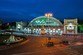 Hua Lamphong Railway Station
 -
 Jim Thompson House
 -
 Lights, Amarin Plaza
 -
 MBK Center on Rama I Road
 -
 Lake, Lumphini Park
 -
 Henri Dunant Road
 -
 Embassy of Japan on Witthayu Road ('Wireless Road') near Lumphini Park
 -
 Erawan Shrine, Ratchaprasong Intersection
 -
 Auditorium, Chulalongkorn University


.jpg)
.jpg)


References
- ^ a b c คณะทำงานหนังสือวัดปทุมวนารามราชวิหาร จุฬาลงกรณ์มหาวิทยาลัย (2011). วัดปทุมวนารามราชวรวิหาร. Chulalongkorn University Press. Reproduced in "เขตประทุมวัน : โดย บัณฑิต จุลาสัย และ รัชดา โชติพานิช". Matichon Online (in Thai). 29 April 2018. Retrieved 11 October 2020.
- ^ a b "พระตำหนักใหม่ วังสระปทุม ลักษณะบ้านเพื่ออาศัยมิใช่วังเจ้านาย ที่ประทับราชสกุลมหิดล". Silpa-mag.com (in Thai). Silpa Wattanatham. 21 January 2020. Retrieved 11 October 2020.
- ^ พีรศรี โพวาทอง (8 June 2020) [Originally published June 2005]. "วังใหม่ที่ปทุมวัน : ประวัติศาสตร์สถาปัตยกรรม "ความทรงจำอันเลือนราง"". Silpa Wattanatham (in Thai). Retrieved 11 October 2020.
- ^ Prepanod Nainapat (4 April 2017). "'สยามสแควร์' ถนนวัยรุ่นสู่วัยรุ่นอีกรุ่น". The Matter (in Thai).
- ^ ยุทธศักดิ์ คณาสวัสดิ์ (25 December 2005). "สยามพารากอน....อีกก้าวหนึ่งของประเทศไทยไปสู่สวรรค์แห่งการชอปปิ้ง". Manager Daily (in Thai). Retrieved 21 October 2020.
- ^ ISBN 9781568985442.
- ^ a b "แผนปฏิบัติราชการประจำปี พ.ศ. 2564 สำนักงานเขตปทุมวัน" (PDF) (in Thai). Pathum Wan District Office. p. 6. Retrieved 12 October 2020.
- ^ Na Thalang, Jeerawat (29 May 2016). "Spinning a living from a dyeing art". Bangkok Post. Retrieved 21 October 2020.
- ^ Biggs, Andrew (21 April 2013). "Where the streets have strange names". Bangkok Post. Retrieved 21 October 2020.
- ^ End of an era for Muay Thai at Lumpini, Bangkok Post Retrieved 28 February 2014.
- ^ "ปิดตำนานไฟปีใหม่ "เพนนินซูล่า พลาซ่า" แลนด์มาร์ค "คริสต์มาส" แรก ณ ราชดำริ". Krungthep Thurakij. 8 December 2021. Retrieved 2022-04-23.
- ^ "ปิดตำนาน! "เดอะ เพนนินซูล่า พลาซ่า" ห้างไฮเอนด์ของเหล่าคนดังในอดีต". MGR Online. 21 April 2022. Retrieved 2022-04-23.
External links
- Pathum Wan District Office website (in Thai)
.svg)