Penfeld
Appearance
| Penfeld | |
|---|---|
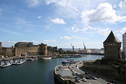
 Penfeld River and the arsenal of Brest | |
| Location | |
| Country | France |
| Physical characteristics | |
| Source | |
| • location | Brittany |
| Mouth | Atlantic Ocean |
• location | Brest |
• coordinates | 48°22′40″N 4°29′38″W / 48.37778°N 4.49389°W |
| Length | 16 km (9.9 mi) |
The Penfeld (French pronunciation: [pɛ̃fɛl];[1] Breton: Penfell) is a 16 km (9.9 mi) French coastal river.[2] The town of Brest, in Finistère, has grown up on its left (east) bank.
Course
Its source is in the town of
interglacial periods of the Quaternary Era
. That explains its depth, which allows deep-draught ships to go quite a way upstream, with tides running up it up to 8 m (26 ft) deep.
At Brest, the Penfeld is crossed by the
Pont de l’Harteloire then, some way downstream, by the Pont de Recouvrance, the largest vertical-lift bridge in Europe until it was dethroned by the Pont Gustave-Flaubert
in 2007.
In its last stretch, within embankments 25–30 m (82–98 ft) high, the Penfeld runs through the Brest naval base, and at its mouth (a site whose strategic importance has been recognised since antiquity) is the 15th-century Château de Brest.
See also

- Pont de l'Harteloire
- Pont National — Pont de Recouvrance
- Recouvrance
- Arsenal de Brest
References
- ^ The d was added in the 17th century by a naval engineer influenced by the German word feld - the name is masculine in the Breton language.
- .


