
Pentland Township, Michigan
Pentland Township, Michigan | ||
|---|---|---|
FIPS code 26-63500[1] | | |
| GNIS feature ID | 1626892[2] | |
| Website | Official website | |
Pentland Township is a civil township of Luce County in the U.S. state of Michigan. As of the 2020 census, the township population was 1,564.[3]
Geography
According to the United States Census Bureau, the township has a total area of 107.34 square miles (278.01 km2), of which 106.79 square miles (276.58 km2) is land and 0.55 square miles (1.4 km2) (0.51%) is water.[4]
Demographics
At the
In 2000, there were 693 households, out of which 32.8% had children under the age of 18 living with them, 62.3% were married couples living together, 8.4% had a female householder with no husband present, and 25.5% were non-families. 21.9% of all households were made up of individuals, and 9.7% had someone living alone who was 65 years of age or older. The average household size was 2.55 and the average family size was 2.95. In the township the population was spread out, with 26.4% under the age of 18, 6.5% from 18 to 24, 27.6% from 25 to 44, 24.6% from 45 to 64, and 14.9% who were 65 years of age or older. The median age was 39 years. For every 100 females, there were 100.4 males. For every 100 females age 18 and over, there were 98.8 males.
As of 2000, the median income for a household in the township was $35,990, and the median income for a family was $37,991. Males had a median income of $34,583 versus $22,692 for females. The
Transportation
Airports
 Luce County Airport is located within Pentland Township.
Major highways
 M-28 runs east–west through the center of the township.
 M-117 runs south–north through the western portion of the township and ends at M-28.
 M-123 runs north–south has its northern terminus within the township at M-28. Because of the highway's angle, it is the "northern" terminus, even though it is running in a south direction.
References
- ^ a b "U.S. Census website". United States Census Bureau. Retrieved January 31, 2008.
- ^ U.S. Geological Survey Geographic Names Information System: Pentland Township, Michigan
- ^ a b c "Explore Census Data". data.census.gov. Retrieved August 4, 2023.
- 2010 United States Census. United States Census Bureau. September 2012. p. 31 Michigan. Archived(PDF) from the original on October 19, 2012. Retrieved March 7, 2021.
Municipalities and communities of Luce County, Michigan, United States | ||
|---|---|---|
| Village | 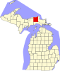 | |
| Civil townships | ||
| Unincorporated communities |
| |
| Indian reservation | ||
| Footnotes | ‡This populated place also has portions in an adjacent county or counties | |
| ||