
Peuvillers
Peuvillers | |
|---|---|
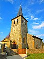
 The church and surroundings in Peuvillers | |
Location of Peuvillers  | |
 Peuvillers  Peuvillers | |
| Coordinates: 49°22′15″N 5°23′41″E / 49.3708°N 5.3947°E | |
| Country | France |
| Region | Grand Est |
| Department | Meuse |
| Arrondissement | Verdun |
| Canton | Montmédy |
| Intercommunality | CC Damvillers Spincourt |
| Government | |
| • Mayor (2020–2026) | Matthieu Nivelet[1] |
| Area 1 | 4.86 km2 (1.88 sq mi) |
| Population (2021)[2] | 61 |
| • Density | 13/km2 (33/sq mi) |
| Time zone | UTC+01:00 (CET) |
| • Summer (DST) | UTC+02:00 (CEST) |
| INSEE/Postal code | 55403 /55150 |
| Elevation | 194–216 m (636–709 ft) (avg. 197 m or 646 ft) |
| 1 French Land Register data, which excludes lakes, ponds, glaciers > 1 km2 (0.386 sq mi or 247 acres) and river estuaries. | |
Peuvillers is a commune in the Meuse department in Grand Est in north-eastern France.[3]
History
Peuvillers was a part of French Luxembourg from 1659 until 1790, in the bailiwick of Marville. The hospital of 14th Foot Artillery Regiment was located in Peuvillers where the German NCO Heinrich Wilhelm Koch died at the age of 20. He was buried in January 1917 at the Ladhof Cemetery in Colmar, Alsace, where his family lived.
Gallery
-
 Eglise Peuvillers
 -
 Peuvillers


See also
References
Wikimedia Commons has media related to Peuvillers.
- ^ "Répertoire national des élus: les maires". data.gouv.fr, Plateforme ouverte des données publiques françaises (in French). 9 August 2021.
- ^ "Populations légales 2021". The National Institute of Statistics and Economic Studies. 28 December 2023.
- ^ Commune de Peuvillers (55403), INSEE
| Authority control databases: National |
|---|
This Meuse geographical article is a stub. You can help Wikipedia by expanding it. |