Reigolil River
Appearance
| Reigolil River | |
|---|---|
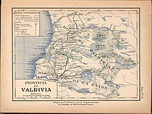
 Trancura River, east of Villarica Lake in a 1903 map | |
| Location | |
| Country | Chile |
| Physical characteristics | |
| Mouth | |
• location | Trancura River |
Reigolil River (
La Araucanía Region, Chile[1]. Reigolil River flows from north to south following the Reigolil-Pirihueico Fault. The river has a catchment area that includes the southern slopes of Sollipulli Volcano in the north and a large portion of land east of Huerquehue National Park
.
See also
- ^ "Araucanía region, Chile". Brittanica. nd.

