
Reither Spitze
| Reither Spitze | |
|---|---|
Tyrol, Austria
| |
| Parent range | Erlspitze Group, Karwendel |
| Geology | |
| Type of rock | Dolomite |
| Climbing | |
| Normal route | From the Nördlinger Hut |
The Reither Spitze is a mountain in the
Tyrol that, thanks to its location at the southwestern end of the Erlspitze Group, is particularly well known for its great views of the surrounding area from its summit. Its name is derived the village of Reith bei Seefeld
, which lies at its southwestern foot.
The Schlossbach, a tributary of the River Inn, rises on the mountainside.
Ascent
The summit of the Reither Spitze may be reached in a 20-minute climb from the
UIAA level III difficulty.[2]
-
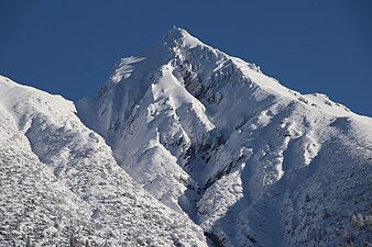 Reither Spitze in winter
 -
 The Reither Spitze from Seefeld
 -
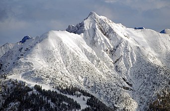
 The Härmelekopf and Reither Spitze in winter
 -
 View from the foot of the Hohe Munde


.JPG)
Geology
The summit of the Reither Spitze and the arête of the Seefelder Spitze (2,221


References
- ISBN 3-7633-1200-5, p. 136.
- ISBN 3-7633-1208-0, p. 131.
- ^ Kartierungsbericht der Geologischen Bundesanstalt, as at 14 March 2009 (pdf; 243 kB)
- ^ Geologische Karte der Republik Österreich 1:50,000, Sheet 117 Zirl, Geologische Bundesanstalt, Vienna, 1992.
External links
 Media related to Reither Spitze at Wikimedia Commons