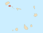
Ribeira de Calhau
Ribeira de Calhau | |
|---|---|
Settlement | |
 Beach of Calhau | |
| Coordinates: 16°50′28″N 24°54′04″W / 16.841°N 24.901°W | |
| Country | Cape Verde |
| Island | São Vicente |
| Municipality | São Vicente |
| Civil parish | Nossa Senhora da Luz |
| Elevation | 7 m (23 ft) |
| Population (2010)[1] | |
| • Total | 1,177 |
| ID | 21105 |
Ribeira de Calhau is a settlement in the eastern part of the island of
Monte Verde
.
The Cape Verde Atmospheric Observatory "Humberto Duarte Fonseca" is situated 1 km north of Calhau. It is part of a German-UK initiative to undertake long-term ground- and ocean-based observations in the tropical Eastern North Atlantic Ocean region.[2]
Climate
Calhau has a hot desert climate like most of the island. The average annual temperature is 22.6 °C. Average rainfall is 129 millimeters.[3]
| Climate data for Calhau, 86 metres ASL | |||||||||||||
|---|---|---|---|---|---|---|---|---|---|---|---|---|---|
| Month | Jan | Feb | Mar | Apr | May | Jun | Jul | Aug | Sep | Oct | Nov | Dec | Year |
| Mean daily maximum °C (°F) | 23.0 (73.4) |
22.4 (72.3) |
23.2 (73.8) |
23.7 (74.7) |
24.1 (75.4) |
25.2 (77.4) |
26.7 (80.1) |
26.9 (80.4) |
26.3 (79.3) |
25.8 (78.4) |
25.8 (78.4) |
24.1 (75.4) |
24.8 (76.6) |
| Daily mean °C (°F) | 20.8 (69.4) |
20.5 (68.9) |
20.9 (69.6) |
21.3 (70.3) |
21.7 (71.1) |
23.0 (73.4) |
24.1 (75.4) |
24.7 (76.5) |
24.7 (76.5) |
24.3 (75.7) |
23.6 (74.5) |
22.1 (71.8) |
22.6 (72.7) |
| Mean daily minimum °C (°F) | 18.7 (65.7) |
18.6 (65.5) |
18.7 (65.7) |
18.9 (66.0) |
19.4 (66.9) |
20.8 (69.4) |
21.5 (70.7) |
22.6 (72.7) |
23.2 (73.8) |
22.8 (73.0) |
21.5 (70.7) |
20.2 (68.4) |
20.6 (69.1) |
| Average precipitation mm (inches) | 5 (0.2) |
1 (0.0) |
1 (0.0) |
0 (0) |
0 (0) |
0 (0) |
4 (0.2) |
19 (0.7) |
67 (2.6) |
17 (0.7) |
10 (0.4) |
5 (0.2) |
129 (5.1) |
| Source: [3] | |||||||||||||
Notable person
- Vasco Martins, singer and composer
References
- ^ "2010 Census results". Instituto Nacional de Estatística Cabo Verde (in Portuguese). 24 November 2016.
- ^ Cape Verde Atmospheric Observatory
- ^ a b Climate-Data.ORG, retrieved 12 September 2018


