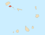
São Pedro, Cape Verde
Appearance
São Pedro | |
|---|---|
Settlement | |
 | |
| Coordinates: 16°49′26″N 25°03′36″W / 16.824°N 25.060°W | |
| Country | Cape Verde |
| Island | São Vicente |
| Municipality | São Vicente |
| Civil parish | Nossa Senhora da Luz |
| Elevation | 22 m (72 ft) |
| Population (2010)[1] | |
| • Total | 991 |
| ID | 21107 |
São Pedro is a village in the southwestern part of the island of
Farol de D. Amélia
sits on the Ponta Machado, 3 km west of the village.

References
- ^ "2010 Census results". Instituto Nacional de Estatística Cabo Verde (in Portuguese). 24 November 2016.
- ^ Jacques-Nicolas Bellin (1747). "Carte des Isles du Cap Verd = Kaart van de Eilanden van Kabo Verde" (in French).
External links
- Discover the Lighthouse (in French)


