
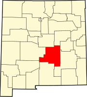
Riverside, Lincoln County, New Mexico
Riverside, New Mexico | ||
|---|---|---|
ZIP codes 88343 | ||
| GNIS feature ID | 898592 | |
Riverside is an
U.S. 380 and U.S. 70, between the town of Lincoln and Roswell.[2] The nearest community is Sunset about a mile upstream.[2]
History
The settlement was established after World War I when W. O. Norman opened a filling station there, called "Big Hill Filling Station", and a car camp. In 1930 Norman sold his interest and the place was renamed "Riverside Camp", which was soon shortened to "Riverside".[3][4]
References
- ^ "Riverside". Geographic Names Information System. United States Geological Survey, United States Department of the Interior., 13 November 1980
- ^ a b Sunset Quadrangle, New Mexico – Lincoln County (Map) (provisional 1988 ed.). 1:24,000. 7.5 minutes series (topographic). United States Geological Survey. 1988.
- ISBN 0-8263-1689-1.
- ^ "Summary of Hondo Valley Community Histories" (PDF). Archaeological and Cultural Education Consultants. Archived from the original on June 29, 2014.
 | ||||
Town | ||||
Villages | ||||
| CDP | ||||
| Other unincorporated communities | ||||
Ghost towns | ||||
| ||||
This New Mexico state location article is a stub. You can help Wikipedia by expanding it. |