
Rockland Township, Venango County, Pennsylvania
Rockland Township, Venango County, Pennsylvania | |
|---|---|
814 | |
| FIPS code | 42-121-65560 |
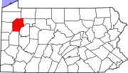
Rockland Township is a township in
History
A prehistoric petroglyph, the Indian God Rock, is located along the Allegheny River in Rockland Township.[3] Other petroglyphs, known as the "Rainbow Rocks Petroglyphs Site," lie farther east in the township near the community of Van.[4] It is listed on the National Register of Historic Places, along with the Rockland Furnace.[5]
Geography
According to the United States Census Bureau, the township has a total area of 49.7 square miles (128.8 km2), all land.
Demographics
| Census | Pop. | Note | %± |
|---|---|---|---|
| 2010 | 1,456 | — | |
| 2020 | 1,245 | −14.5% | |
| 2022 (est.) | 1,226 | [2] | −1.5% |
| U.S. Decennial Census[6] | |||

As of the
There were 556 households, of which 27.9% had children under the age of 18 living with them, 63.5% were married couples living together, 5.6% had a female householder with no husband present, and 28.2% were non-families. 24.6% of all households were made up of individuals, and 11.2% were someone living alone who was 65 years of age or older. The average household size was 2.42 and the average family size was 2.89.
In the township the population was spread out, with 21.8% under the age of 18, 5.8% from 18 to 24, 25.8% from 25 to 44, 28.7% from 45 to 64, and 18.0% who were 65 years of age or older. The median age was 43 years. For every 100 females, there were 105.8 males. For every 100 females age 18 and over there were 104.1 males.
The median income for a household in the township was $31,129, and the median income for a family was $34,491. Males had a median income of $31,477 compared with $22,411 for females. The
References
- ^ "2016 U.S. Gazetteer Files". United States Census Bureau. Retrieved August 14, 2017.
- ^ a b c d Bureau, US Census. "City and Town Population Totals: 2020-2022". Census.gov. US Census Bureau. Retrieved June 17, 2023.
- ^ Cowin, Verna L. (April 15, 1982). "National Register of Historic Places Inventory—Nomination Form: Archeological Site 36 LY 37" (PDF). National Park Service. Retrieved December 8, 2009. [dead link]
- ^ Swauger, James L. Rock Art of the Upper Ohio Valley. Graz: Akademische Druck- und Verlagsanstalt, 1974, 71/115.
- ^ "National Register Information System". National Register of Historic Places. National Park Service. July 9, 2010.
- ^ "Census of Population and Housing". Census.gov. Retrieved June 4, 2016.
- ^ "U.S. Census website". United States Census Bureau. Retrieved January 31, 2008.
 | ||||
| Boroughs | ||||
| Townships | ||||
| CDPs | ||||
| Unincorporated communities | ||||
| Ghost town | ||||
| Footnotes | ‡This populated place also has portions in an adjacent county or counties | |||
| ||||