
Rural Hall, North Carolina
Rural Hall, North Carolina | ||
|---|---|---|
FIPS code 37-58360[3] | | |
| GNIS feature ID | 2407257[2] | |
| Website | www | |
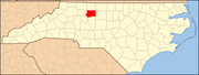
Rural Hall is a town in Forsyth County, North Carolina, United States. It is a part of the Piedmont Triad. The population was 3,360 at the 2020 census.[4] The town has one public park: Covington Memorial Park.
Geography
Rural Hall is located in northern Forsyth County. It is bordered to the south by the city of Winston-Salem, and the village of Tobaccoville is to the west. Downtown Winston-Salem is 12 miles (19 km) to the south via North Carolina Highway 66 and U.S. Route 52.
According to the United States Census Bureau, the town of Rural Hall has a total area of 2.9 square miles (7.4 km2), of which 0.01 square miles (0.02 km2), or 0.32%, is water.[5]
Demographics
| Census | Pop. | Note | %± |
|---|---|---|---|
| 1980 | 1,336 | — | |
| 1990 | 1,652 | 23.7% | |
| 2000 | 2,464 | 49.2% | |
| 2010 | 2,937 | 19.2% | |
| 2020 | 3,360 | 14.4% | |
| 2021 (est.) | 3,413 | [4] | 1.6% |
| U.S. Decennial Census[6] | |||
2020 census
| Race | Number | Percentage |
|---|---|---|
White (non-Hispanic)
|
2,017 | 60.19% |
Black or African American (non-Hispanic)
|
678 | 20.23% |
Native American
|
14 | 0.42% |
Asian
|
19 | 0.57% |
Pacific Islander
|
2 | 0.06% |
Other/Mixed
|
188 | 5.61% |
Latino
|
433 | 12.92% |
As of the 2020 United States census, there were 3,351 people, 1,360 households, and 857 families residing in the town.
2000 census
As of the
There were 1,081 households, out of which 27.8% had children under the age of 18 living with them, 49.5% were married couples living together, 12.1% had a female householder with no husband present, and 34.7% were non-families. 30.5% of all households were made up of individuals, and 12.0% had someone living alone who was 65 years of age or older. The average household size was 2.28 and the average family size was 2.83.
In the town, the population was spread out, with 22.6% under the age of 18, 8.4% from 18 to 24, 29.9% from 25 to 44, 23.8% from 45 to 64, and 15.4% who were 65 years of age or older. The median age was 39 years. For every 100 females, there were 92.3 males. For every 100 females age 18 and over, there were 88.2 males.
The median income for a household in the town was $36,477, and the median income for a family was $46,116. Males had a median income of $31,939 versus $26,435 for females. The
History
The earliest settler was Anthony Bitting (1738-1804), who was born in Pennsylvania to a German American family. In the 1770s he moved from
Another early settler was Johann Adam Geiger (Kiger) who donated 102 acres (0.41 km2) to the Nazareth Evangelical Lutheran Church, which still serves the community today. The town developed after the Cape Fear & Yadkin Valley Railroad erected a station in 1887.[8]
Rural Hall now is the operational center of the Yadkin Valley Railroad, and many of the Yadkin Valley locomotives can be found idling there when not working.
The
External links
References
- ^ "ArcGIS REST Services Directory". United States Census Bureau. Retrieved September 20, 2022.
- ^ a b U.S. Geological Survey Geographic Names Information System: Rural Hall, North Carolina
- ^ a b "U.S. Census website". United States Census Bureau. Retrieved January 31, 2008.
- ^ a b Bureau, US Census. "City and Town Population Totals: 2020-2021". Census.gov. US Census Bureau. Retrieved July 9, 2022.
- ^ "Geographic Identifiers: 2010 Census Summary File 1 (G001), Rural Hall town, North Carolina". American FactFinder. U.S. Census Bureau. Archived from the original on February 13, 2020. Retrieved June 27, 2016.
- ^ "Census of Population and Housing". Census.gov. Retrieved June 4, 2016.
- ^ "Explore Census Data". data.census.gov. Retrieved December 20, 2021.
- ^ Powell, William S. The North Carolina Gazetteer: A Dictionary of Tar Heel Places, Chapel Hill, NC: The University of North Carolina Press, 1968.
- ^ "National Register Information System". National Register of Historic Places. National Park Service. July 9, 2010.
 | ||||
Towns | ||||
| Villages | ||||
| Townships | ||||
| CDP | ||||
| Unincorporated communities | ||||
| Footnotes | ‡This populated place also has portions in an adjacent county or counties | |||
| ||||
| International | |
|---|---|
| National | |