
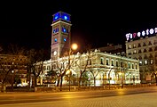
Salamanca (Madrid)
Salamanca | |
|---|---|
.jpg) | |
 | |
| Country | Spain |
| Region | Community of Madrid |
| Municipality | Madrid |
| Government | |
| • Councillor-President | Cayetana Hernández de la Riva (PP, 2023) |
| Area | |
• Total | 5.38 km2 (2.08 sq mi) |
| Population | 147,707 |
| • Density | 27,418/km2 (71,010/sq mi) |
| Madrid district number | 4 |
 | |
Salamanca is one of the 21 districts that form the city of Madrid, Spain. Salamanca is located to the northeast of the historical center of Madrid. Salamanca lies east of the district of Chamberí, south of Chamartín, and north of Retiro. Salamanca counts approximately 151.000 inhabitants.
It takes its name from the 1st Marquess of Salamanca, José de Salamanca y Mayol, a powerful businessman that was one of the richest men in the world during the mid nineteenth century.[1]
Geography
Overview
The limits of Salamanca district are defined by the
Subdivision
The district is administratively divided into 6 wards (Barrios):
- Castellana
- Fuente del Berro
- Goya
- Guindalera
- Lista
- Recoletos
History
The population of Madrid at the beginning of the 19th century was about 220,000, increasing to 300,000 inhabitants in the late 1850s. However, the city was still enclosed within the defensive wall built in 1625 by king
Since then, the Salamanca district has been one of the most representative areas for
_01.jpg)
Politics
The district of Salamanca had more than 72% of its votes given to the
Demographics
Salamanca has about 150,775 inhabitants in 58.742 houses, with a density of 279 people per hectare.
Economy
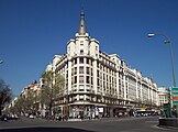
Salamanca is one of the wealthiest and most expensive areas in Madrid, with a comparatively high cost of living and some of the most expensive real estate in the city. Calle de Serrano is the third most expensive street in Spain, according to Cushman & Wakefield.[2]
A significant number of diplomatic missions are in Salamanca, such as the Swiss embassy at Calle de Núñez de Balboa and C/ Goya, the French embassy on C/ Villalar, the United States embassy on C/ Serrano, and the Italian embassy on C/ Juan Bravo.
Salamanca is also home to the IE Business School (previously Instituto de Empresa) which is ranked among the top 10 business schools in the world.[3]
Photogallery
-
 Arab House
 -
 Calle de Alcalá (street)
 -
 Paseo de la Castellana (avenue)
_05.jpg)
_01.jpg)
_44.jpg)
-
-
 1903 house-palace
 -
 Juan March Foundation
_02.jpg)
_02.jpg)
_01.jpg)
References
- ^ Vázquez, Ana (2 December 2021). "Marqués de Salamanca, el malagueño que amasó la mayor fortuna de España". Cadena SER. Retrieved 16 September 2024.
- ^ (in Spanish) Infos on www.economista.es
- ^ (in Spanish) [1]
External links
![]() Media related to Salamanca District, Madrid at Wikimedia Commons
Media related to Salamanca District, Madrid at Wikimedia Commons
| Arganzuela |
| |
|---|---|---|
| Barajas | ||
| Carabanchel | ||
| Centro | ||
| Chamartín | ||
| Chamberí | ||
| Ciudad Lineal |
| |
| Fuencarral-El Pardo |
| |
| Hortaleza |
| |
| Latina | ||
| Moncloa-Aravaca | ||
| Moratalaz |
| |
| Puente de Vallecas | ||
| Retiro | ||
| Salamanca |
| |
| San Blas-Canillejas | ||
Tetuán |
| |
| Usera | ||
| Vicálvaro | ||
| Villa de Vallecas | ||
| Villaverde |
| |
40°25′48″N 3°40′40″W / 40.43000°N 3.67778°W
| International | |
|---|---|
| National | |