Saltillo, Pennsylvania
Saltillo, Pennsylvania | |
|---|---|
Borough | |
814 | |
| FIPS code | 42-67632 |
| Local phone exchanges: 447, 448 | |
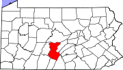
Saltillo is a borough in Huntingdon County, Pennsylvania, United States. The population was 346 at the 2010 census.[3]
History
Saltillo was named after the Mexican War
Saltillo was an important place on the EBT, acting as a base station for the long grade up to Broad Top Mountain. The EBT had a three-track yard, a station, a water tank and a turning wye located here. Just after the turn of the 20th century a large ganister quarry was established above Saltillo on Jacks Mountain by Mount Union Refractories (later United States Refractories and North American Refractories) to supply their plant in Mount Union. In 1942 a spur was built from the EBT yard in Saltillo, which climbed the mountain to a tipple below the quarry. The branch was the steepest track on the EBT and remained in service until the line closed in 1956. The quarry continued to operate into the 1970s, served by trucks. The EBT tracks in Saltillo are still in place. The water tank was burned by vandals in the late 1980s and the station was demolished in the mid-2000s after being allowed to deteriorate to deplorable condition.
Around 1935 the skeleton of a
The Hudson Grist Mill at the southwest edge of town was listed on the National Register of Historic Places in 1990.[4]
Geography
Saltillo is located in southern Huntingdon County at 40°12′39″N 78°00′21″W / 40.2109°N 78.0057°W.[5] It sits in the valley of North Spring Branch at the western foot of Jacks Mountain, near the mountain's southern end. Pennsylvania Routes 655 and 829 run through the borough as Main Street. PA 655 leads south 14 miles (23 km) to Hustontown, while PA 829 leads southeast 1.7 miles (2.7 km) to Three Springs. The two highways together lead north 2 miles (3 km) to where they split in Knightsville. Huntingdon, the county seat, is 22 miles (35 km) north via PA 655 and U.S. Route 22.
According to the United States Census Bureau, the borough has a total area of 0.25 square miles (0.65 km2), all land.[3]
Demographics
| Census | Pop. | Note | %± |
|---|---|---|---|
| 1880 | 227 | — | |
| 1890 | 254 | 11.9% | |
| 1900 | 377 | 48.4% | |
| 1910 | 410 | 8.8% | |
| 1920 | 418 | 2.0% | |
| 1930 | 386 | −7.7% | |
| 1940 | 433 | 12.2% | |
| 1950 | 435 | 0.5% | |
| 1960 | 395 | −9.2% | |
| 1970 | 341 | −13.7% | |
| 1980 | 373 | 9.4% | |
| 1990 | 347 | −7.0% | |
| 2000 | 343 | −1.2% | |
| 2010 | 346 | 0.9% | |
| 2020 | 309 | −10.7% | |
| U.S. Decennial Census[6] | |||
As of the
There were 135 households, out of which 34.8% had children under the age of 18 living with them, 67.4% were married couples living together, 4.4% had a female householder with no husband present, and 25.2% were non-families. 22.2% of all households were made up of individuals, and 11.9% had someone living alone who was 65 years of age or older. The average household size was 2.54 and the average family size was 3.01.
In the borough the population was spread out, with 27.7% under the age of 18, 5.8% from 18 to 24, 33.5% from 25 to 44, 18.1% from 45 to 64, and 14.9% who were 65 years of age or older. The median age was 34 years. For every 100 females there were 101.8 males. For every 100 females age 18 and over, there were 103.3 males.
The median income for a household in the borough was $32,917, and the median income for a family was $40,000. Males had a median income of $28,750 versus $16,250 for females. The
References
- ^ "ArcGIS REST Services Directory". United States Census Bureau. Retrieved October 16, 2022.
- ^ "Census Population API". United States Census Bureau. Retrieved Oct 12, 2022.
- ^ a b "Geographic Identifiers: 2010 Census Summary File 1 (G001): Saltillo borough, Pennsylvania". American Factfinder. U.S. Census Bureau. Archived from the original on February 13, 2020. Retrieved January 22, 2018.
- ^ "National Register Information System". National Register of Historic Places. National Park Service. July 9, 2010.
- ^ "US Gazetteer files: 2010, 2000, and 1990". United States Census Bureau. 2011-02-12. Retrieved 2011-04-23.
- ^ "Census of Population and Housing". Census.gov. Retrieved June 4, 2016.
- ^ "U.S. Census website". United States Census Bureau. Retrieved 2008-01-31.
External links
 Media related to Saltillo, Pennsylvania at Wikimedia Commons

