
San Gabriel, La Union
This article needs additional citations for verification. (August 2013) |
San Gabriel
Baka-Burnotan | ||
|---|---|---|
| Municipality of San Gabriel | ||
 San Gabriel Municipal Hall | ||
 Flag  Seal | ||
| Nickname(s): The Softbroom Capital of the North; Highland Vegetable and Tourism Adventure Paradise of La Union | ||
| Motto(s): San Gabriel, Mapangnamnamaan | ||
| Anthem: San Gabriel Hymn | ||
 Map of La Union with San Gabriel highlighted | ||
OpenStreetMap  | ||
.svg) San Gabriel Location within the Philippines | ||
| Coordinates: 16°40′N 120°24′E / 16.67°N 120.4°E | ||
| Country | Philippines | |
| Region | Ilocos Region | |
| Province | La Union | |
| District | 1st district | |
Founded | 1947 | |
| Named for | Saint Gabriel | |
| Barangays | 15
(see Vice Mayor Ramolito Guinomma | |
| • Representative | Paolo Ortega | |
| • Municipal Council | Members | |
| • ZIP code | 2513 | |
| PSGC | ||
| IDD : area code | +63 (0)72 | |
| Native languages | Ilocano Tagalog | |
| Website | https://www.sangabriellaunion.gov.ph/government | |
San Gabriel , officially the Municipality of San Gabriel (
Etymology
The name of the town derived from the patron saint Gabriel.
History
San Gabriel was formerly known as
On April 19, 1897, a
In 1906, San Gabriel was made into a township under the sub-province of
Geography
San Gabriel is the largest municipality by land area in the province of
The town is 17 kilometres (11 mi) from San Fernando and 286 kilometres (178 mi) from Manila.
Barangays
San Gabriel is politically subdivided into 15
- Amontoc
- Apayao
- Balbalayang
- Bayabas
- Bucao
- Bumbuneg
- Daking
- Lacong
- Lipay Este
- Lipay Norte
- Lipay Proper
- Lipay Sur
- Lon-oy
- Poblacion
- Polipol
Climate
| Climate data for San Gabriel, La Union | |||||||||||||
|---|---|---|---|---|---|---|---|---|---|---|---|---|---|
| Month | Jan | Feb | Mar | Apr | May | Jun | Jul | Aug | Sep | Oct | Nov | Dec | Year |
| Mean daily maximum °C (°F) | 30 (86) |
31 (88) |
32 (90) |
33 (91) |
32 (90) |
31 (88) |
30 (86) |
30 (86) |
30 (86) |
31 (88) |
31 (88) |
31 (88) |
31 (88) |
| Mean daily minimum °C (°F) | 21 (70) |
22 (72) |
23 (73) |
25 (77) |
26 (79) |
26 (79) |
25 (77) |
25 (77) |
25 (77) |
24 (75) |
23 (73) |
22 (72) |
24 (75) |
| Average precipitation mm (inches) | 42 (1.7) |
48 (1.9) |
74 (2.9) |
110 (4.3) |
269 (10.6) |
275 (10.8) |
362 (14.3) |
325 (12.8) |
330 (13.0) |
306 (12.0) |
126 (5.0) |
61 (2.4) |
2,328 (91.7) |
| Average rainy days | 11.2 | 12.0 | 17.1 | 21.2 | 27.1 | 26.8 | 28.1 | 27.0 | 26.0 | 24.5 | 17.7 | 12.4 | 251.1 |
| Source: Meteoblue[10] | |||||||||||||
Demographics
| Year | Pop. | ±% p.a. |
|---|---|---|
| 1918 | 3,485 | — |
| 1939 | 5,293 | +2.01% |
| 1948 | 5,805 | +1.03% |
| 1960 | 7,546 | +2.21% |
| 1970 | 8,527 | +1.23% |
| 1975 | 9,808 | +2.85% |
| 1980 | 10,248 | +0.88% |
| 1990 | 12,532 | +2.03% |
| 1995 | 13,489 | +1.39% |
| 2000 | 14,909 | +2.17% |
| 2007 | 15,803 | +0.81% |
| 2010 | 16,628 | +1.87% |
| 2015 | 18,172 | +1.71% |
| 2020 | 18,943 | +0.82% |
| Source: Philippine Statistics Authority[11][12][13][14] | ||
In the 2020 census, the population of San Gabriel, La Union, was 18,943 people,[4] with a density of 150 inhabitants per square kilometre or 390 inhabitants per square mile.
Economy
Graphs are unavailable due to technical issues. There is more info on Phabricator and on MediaWiki.org. |
San Gabriel is an agricultural town. In its early days, the people of San Gabriel were engaged mainly in highland farming as their means of livelihood. They produced rice, corn, sweet potatoes, and other root crops. As years passed, crop production decreased due to massive soil erosion in the uplands. Nevertheless, the inhabitants decided to improve their farming techniques and started making terraces. The perseverance of the people in constructing rice terraces and irrigation system along the hills and mountains of San Gabriel caused agricultural productivity to rebound.
Bananas and tiger grass ("
Government
Local government
San Gabriel, belonging to the first congressional district of the province of La Union, is governed by a mayor designated as its local chief executive and by a municipal council as its legislative body in accordance with the Local Government Code. The mayor, vice mayor, and the councilors are elected directly by the people through an election which is being held every three years.
Elected officials
| Position | Name |
|---|---|
| Congressman | Francisco Paolo Ortega |
| Mayor | Lany B. Carbonell |
| Vice-Mayor | Ramolito A. Guinomma |
| Councilors | Mario P. Aligo |
| Jerry T. Fernandez | |
| Geoffrey D. Awingan | |
| Mardo A. Bang-oa | |
| Isagani L. Dumaoang | |
| Mauricio P. Canutab | |
| Dominador P. Abuan | |
| Danilo A. Elias JR. |
Tourism
- Gumayenggeng Falls at Barangay Lipay
- Katebbegan Fall at Barangay Lipay Proper
- Bakes Falls and Lon-oy Spring at Barangay Lon-oy
- Lineng Pool at Poblacion
- Tinnag-Americano Falls at Barangay Polipol
- Tangadan Falls located at Barangay Amontoc[24]
Education
High schools
The town has 4 Public High Schools and 1 Private School.
- Saint Gabriel the Archangel High School, former (San Gabriel Academy) is the only private school secondary in the municipality, a Christian School that demands love and discipline from all who join the SGA High School Family.
- Balbalayang National High School
- Lipay Integrated School
- San Gabriel Senior High School
- San Gabriel Vocational High School
Gallery
-
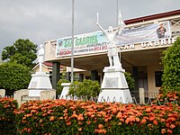 Municipal hall
 -
 Police station
 -
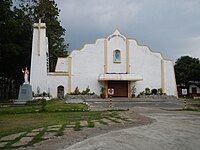
 Town center
 -
-
 Rural landscape


References
- ^ https://www.sangabriellaunion.gov.ph/government/elected-officials/
- (DILG)
- (PDF) from the original on 25 May 2021. Retrieved 16 July 2021.
- ^ a b c Census of Population (2020). "Region I (Ilocos Region)". Total Population by Province, City, Municipality and Barangay. Philippine Statistics Authority. Retrieved 8 July 2021.
- ^ "PSA Releases the 2018 Municipal and City Level Poverty Estimates". Philippine Statistics Authority. 15 December 2021. Retrieved 22 January 2022.
- ^ a b c d "Municipality of San Gabriel". Provincial Government of La Union: Official Website. Retrieved 5 January 2015.
- ^ a b "Executive Order No. 72, s. 1947". Official Gazette (Philippines). Government of the Philippines. 30 July 1947. Retrieved 20 March 2023.
- ^ "Executive Summary (2013)" (PDF). Commission on Audit. Government of the Philippines. 2013. Retrieved 20 March 2023.
- ^ "Province: La Union". PSGC Interactive. Quezon City, Philippines: Philippine Statistics Authority. Retrieved 12 November 2016.
- ^ "San Gabriel: Average Temperatures and Rainfall". Meteoblue. Retrieved 26 April 2020.
- ^ Census of Population (2015). "Region I (Ilocos Region)". Total Population by Province, City, Municipality and Barangay. Philippine Statistics Authority. Retrieved 20 June 2016.
- ^ Census of Population and Housing (2010). "Region I (Ilocos Region)" (PDF). Total Population by Province, City, Municipality and Barangay. National Statistics Office. Retrieved 29 June 2016.
- ^ Censuses of Population (1903–2007). "Region I (Ilocos Region)". Table 1. Population Enumerated in Various Censuses by Province/Highly Urbanized City: 1903 to 2007. National Statistics Office.
{{cite encyclopedia}}: CS1 maint: numeric names: authors list (link) - ^
"Province of La Union". Municipality Population Data. Local Water Utilities AdministrationResearch Division. Retrieved 17 December 2016.
- ^ "Poverty incidence (PI):". Philippine Statistics Authority. Retrieved 28 December 2020.
- ^ "Estimation of Local Poverty in the Philippines" (PDF). Philippine Statistics Authority. 29 November 2005.
- ^ "2003 City and Municipal Level Poverty Estimates" (PDF). Philippine Statistics Authority. 23 March 2009.
- ^ "City and Municipal Level Poverty Estimates; 2006 and 2009" (PDF). Philippine Statistics Authority. 3 August 2012.
- ^ "2012 Municipal and City Level Poverty Estimates" (PDF). Philippine Statistics Authority. 31 May 2016.
- ^ "Municipal and City Level Small Area Poverty Estimates; 2009, 2012 and 2015". Philippine Statistics Authority. 10 July 2019.
- ^ "PSA Releases the 2018 Municipal and City Level Poverty Estimates". Philippine Statistics Authority. 15 December 2021. Retrieved 22 January 2022.
- ^ "PSA Releases the 2021 City and Municipal Level Poverty Estimates". Philippine Statistics Authority. 2 April 2024. Retrieved 28 April 2024.
- ^ "2019 National and Local Elections" (PDF). Commission on Elections. Retrieved 6 March 2022.
- ^ "Tangadan Falls" (JPG). i.ytimg.com. La Union. Archived from the original on 22 April 2023. Retrieved 10 June 2023.
External links
- Philippine Standard Geographic Code
- Philippine Census Information
- Local Governance Performance Management System
Places adjacent to San Gabriel, La Union | ||||||||||||||||
|---|---|---|---|---|---|---|---|---|---|---|---|---|---|---|---|---|
| ||||||||||||||||