
Schönebecker Aue
| Schönebecker Aue | |
|---|---|
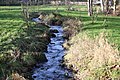
 The Aue downstream from the weir at Schloss Schönebeck. In the background the old water mill | |
 Course of the Schönebecker Aue north of Bremen | |
| Location | |
| Country | Germany |
| States | Lower Saxony and Bremen |
| Physical characteristics | |
| Source | |
| • location | Lange Heide, Osterholz |
| • elevation | approx 40 m (130 ft) above NAP |
| Mouth | |
• location | River Weser in Bremen-Vegesack |
• coordinates | 53°10′08″N 8°37′37″E / 53.16889°N 8.62694°E |
• elevation | 0 m (0 ft) NAP |
| Length | 17.7 km (11.0 mi)[1] |
| Basin features | |
| Progression | Weser→ North Sea |
Schönebecker Aue is a geest stream in Bremen and Lower Saxony, Germany.
The Schönebecker Aue's source is on the Lange Heide plateau near Heilshorn (in Osterholz-Scharmbeck, district Osterholz) in Lower Saxony. Its mouth is in Bremen-Vegesack in the river Weser.
Course
The Schönebecker Aue's total length is 17.7 km (11.0 mi), of which the last 3.1 km (1.9 mi) are in the city of
From a height of approx 40m above
Downstream from the weir, the Aue flows through Bremen suburbs Schönebeck (belongs to Bremen-Vegesack) und Bremen-Vegesack, then for a short way through fields, before reaching another residential area. Bundesautobahn 270 and Uhthoffstraße pass over the Aue, and at Vegesack railway station the stream is led underneath the station's square via a series of pipes. Directly from the pipes, the Aue flows into Vegesack harbor.
Redirection
In its upper reaches, the course of the Aue has been "lightly to moderately altered".
In 2007 a redirection of the Aue around the weir was initiated. This involved a small, naturalistically-formed canal, which leads the stream in a crescent around the weir and was laid out by conservationist volunteers.
The mouth of the Aue was modified several years ago with a stone embankment, through which the migrating fish can still pass. For years before that, the "opening" of the Aue into a harbor basin near to Vegesack railway station was a controversial discussion point in Bremen communal politics.
-
 View of the re-routed river at its upper end
 -
![Mouth of the Schönebecker Aue at the Port of Vegesack [de]](//upload.wikimedia.org/wikipedia/commons/thumb/f/fc/Vegesacker_Hafen_-_M%C3%BCndung_der_Aue.JPG/90px-Vegesacker_Hafen_-_M%C3%BCndung_der_Aue.JPG) Mouth of the Schönebecker Aue at the Port of Vegesack
Mouth of the Schönebecker Aue at the Port of Vegesack

![Mouth of the Schönebecker Aue at the Port of Vegesack [de]](/File:Vegesacker_Hafen_-_M%C3%BCndung_der_Aue.JPG)
See also
References
- ^ Environmental map service of Lower Saxony (Umweltkartendienst des Niedersächsischen Ministeriums für Umwelt, Energie und Klimaschutz)
- ^ "Bestandsaufnahme und Erstbewertung im Land Bremen 2005"PDF file Retrieved 25 May 2012
- ^ "Gewässerstrukturgüte NLWK Betriebsstelle Verden". Archived from the original on 2007-10-28. Retrieved 2012-05-25. Source not retrieved