
Perry Range
| Perry Range | |
|---|---|
 | |
| Geography | |
| Continent | Antarctica |
| Region | Marie Byrd Land |
| Range coordinates | 75°0′S 134°12′W / 75.000°S 134.200°W |
Perry Range (75°0′S 134°12′W / 75.000°S 134.200°W) is a narrow range of mountains, 6 nautical miles (11 km; 6.9 mi) long, separating the lower ends of
Location
The Perry Range trends from north to south. It is south of the
Discovery and name
The Perry Range was discovered and photographed from aircraft of the
-
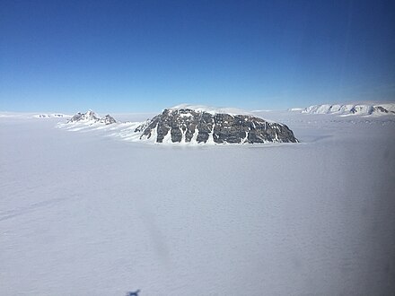
 Aerial view of the range
 -
 Mount Prince in November 2016
 -
 Bleclic Peaks
.jpg)
.jpg)
.jpg)
Features


Features and nearby features to the south include:
Mount Prince
74°58′S 134°11′W / 74.967°S 134.183°W. A prominent butte 640 metres (2,100 ft) high marking the north end of Perry Range. The feature was discovered and photographed from aircraft of the US AS, 1939-41, and was mapped by the United States Geological Survey (USGS) from surveys and air photos, 1959-65. It was named by US-ACAN for Joseph F. Prince, ADR2, United States Navy, Aviation Machinist's Mate with Squadron VXE-6 who participated in several Deep Freeze operations and wintered over at Little America V (1956) and McMurdo Station (1966).[4]
Mount Soond
75°00′S 134°13′W / 75.000°S 134.217°W. A peak 1 nautical mile (1.9 km; 1.2 mi) north of Bleclic Peaks. Mapped by USGS from surveys and United States Navy air photos, 1959-65. Named by US-ACAN for Robert T. Soond, geomagnetist-seismologist at Plateau Station, 1968.[5]
Bleclic Peaks
75°01′S 134°14′W / 75.017°S 134.233°W. Two peaks near the southern end of the Perry Range. Mapped by USGS from surveys and United States Navy air photos, 1959-65. Named by US-ACAN for John P. Bleclic, AGC, United States Navy, senior aerographer's mate on USS Glacier in these coastal waters, 1961-62.[6]
Schloredt Nunatak
75°03′S 134°15′W / 75.050°S 134.250°W. A nunatak 1 nautical mile (1.9 km; 1.2 mi) south of Bleclic Peaks, at the south extremity of the Perry Range. Mapped by USGS from surveys and United States Navy air photos, 1959-65. Named by US-ACAN for Jerry L. Schloredt, Chief Construction Electrician, United States Navy, who served as Nuclear Power Plant Operator with the Naval Nuclear Power Unit at McMurdo Station, 1966, 1967 and 1969.[7]
Bennett Bluff
75°10′S 134°30′W / 75.167°S 134.500°W. A bluff 810 metres (2,660 ft) high between the upper reaches of Venzke Glacier and Berry Glacier, 7 nautical miles (13 km; 8.1 mi) south-southwest of the Perry Range. The bluff has prominent rock exposures on the north wall and was first observed and photographed from aircraft of the USAS on December 18, 1940. I was mapped in detail by USGS, 1959-65. Named by US-ACAN for Clarence E. Bennett, ATI, United States Navy, Aviation Electronics Technician with Squadron VX-6 and a member of the McMurdo Station winter party, 1963.[8]
Peacock Peak
75°11′S 134°30′W / 75.183°S 134.500°W. A peak 1 nautical mile (1.9 km; 1.2 mi) south of Bennett Bluff on the west side of upper Berry Glacier. Mapped by USGS from surveys and United States Navy air photos, 1959-65. Named by US-ACAN for Dennis S. Peacock, ionospheric physicist at Byrd Station, 1970-71.[9]
Poindexter Peak
75°13′S 134°25′W / 75.217°S 134.417°W. Snow-covered peak 1,215 metres (3,986 ft) high rising 4 nautical miles (7.4 km; 4.6 mi) southeast of Bennett Bluff, along the west side of upper Berry Glacier. Mapped by USGS from surveys and United States Navy air photos, 1959-65. Named by US-ACAN for Monte F. Poindexter,
References
- ^ a b Alberts 1995, p. 569.
- ^ Grant Island USGS.
- ^ Mount Kosciusco USGS.
- ^ Alberts 1995, p. 590.
- ^ Alberts 1995, p. 693.
- ^ Alberts 1995, p. 73.
- ^ Alberts 1995, p. 653.
- ^ Alberts 1995, p. 58.
- ^ Alberts 1995, p. 562.
- ^ Alberts 1995, p. 581.
Sources
- Alberts, Fred G., ed. (1995), Geographic Names of the Antarctic (PDF) (2 ed.), United States Board on Geographic Names, retrieved 2023-12-03
 This article incorporates public domain material from websites or documents of the United States Board on Geographic Names.
 - Grant Island, USGS: United States Geological Survey, retrieved 2024-04-06
- Mount Kosciusco, USGS: United States Geological Survey, retrieved 2024-04-06
- This article incorporates public domain material from websites or documents of the United States Geological Survey.